Trail Walking Longpont - en forêt de Retz_15_Longpont_carrefour de Bigoret_AR - Photo

en forêt de Retz_15_Longpont_carrefour de Bigoret_AR

forêts de France

© OpenStreetMap contributors
Length
Length
10.1 km
Max alt
Max alt
160 m
Uphill gradient
Uphill gradient
164 m
Km-Effort
Km-Effort  
12.3 km
Min alt
Min alt
86 m
Downhill gradient
Downhill gradient
164 m
Boucle
Boucle
Yes
Creation date :
2017-03-06 00:00:00.0
Updated on :
2020-11-08 10:58:30.846

(0 Reviews)

Walking
Walking
2h39
Difficulty : Difficult

Scan this QR Code to open this trail in the SityTrail application

FREE GPS app for hiking

Logo SityTrail SityTrail

IGN / Geographical institutes

Download SityTrail from the App Store Download SityTrail from Google Play

Logo SityTrail SityTrail World

The world is yours!

Download SityTrail from the App Store Download SityTrail from Google Play Download SityTrail on Huawei AppGallery

About

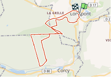
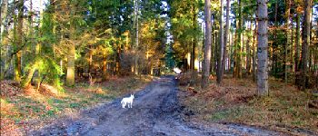
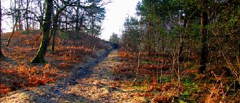
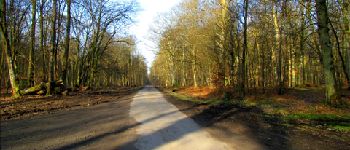
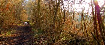
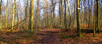
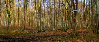
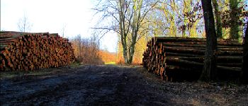
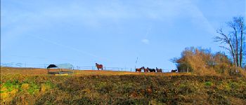
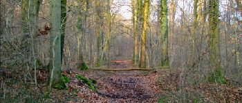
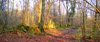
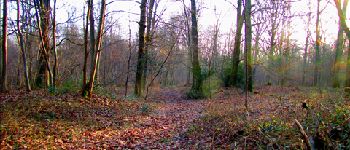
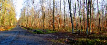
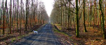
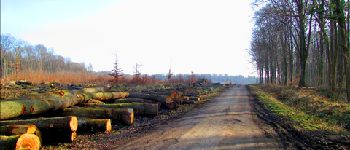
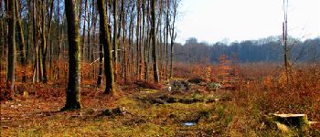
Trail Walking of 10.1 km to be discovered at Hauts-de-France, Aisne, Longpont. This trail is proposed by en forêt de Retz.

Description

voir aussi:
http://foret-de-retz.over-blog.com/

03/2013
au départ de l'abbaye de Longpont, prendre le GR11A aux trois maisons. Prendre la laie du vieux mur sur la gauche (face au centre équestre) puis rejoindre la laie de la Croix Pain Tendre. Continuer jusqu''au carrefour du Pendu. Suivre la route du Pendu jusqu''au carrefour des Tourterelles. Prendre la route de Vauvaudran jusqu''à la voie ferrée près de Corcy. Remonter jusqu''au carrefour de Bigoret. Prendre la laie des Grands Charmes jusqu''au carrefour des Soupirs. Traverser la route du Faîte. Prendre le petit sentier à droite et suivre jusqu''à la route du Pendu. Rejoindre le carrefour du Pendu et prendre la laie de la Croix Pain Tendre jusqu''au carrefour Gaudrillard. Prendre le vieux chemin de Longpont jusqu''à la D2 et rejoindre Longpont.

Elevation profile

Photos

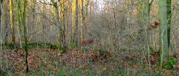
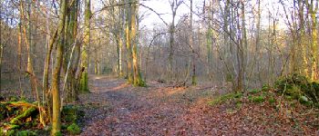
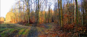
59 photos in total. Please click on a photo to see them all in the gallery.

Points of interest

Point of interest Longpont - Point 3 - Photo
JeanLucA4
LONGPONT 
Point of interest Longpont - Point 5 - Photo
JeanLucA4
LONGPONT 
Point of interest Montgobert - Unnamed POI - Photo
JeanLucA4
MONTGOBERT 
Point of interest Corcy - Point 8 - Photo
JeanLucA4
CORCY 
Point of interest Corcy - Point 9 - Photo
JeanLucA4
CORCY 
Point of interest Corcy - Point 11 - Photo
JeanLucA4
CORCY 
Point of interest Corcy - Point 16 - Photo
JeanLucA4
CORCY 
Point of interest Corcy - Point 17 - Photo
JeanLucA4
CORCY 
Point of interest Corcy - Point 18 - Photo
JeanLucA4
CORCY 
Point of interest Corcy - Point 19 - Photo
JeanLucA4
CORCY 
Point of interest Montgobert - Point 24 - Photo
JeanLucA4
MONTGOBERT 
Point of interest Longpont - Point 25 - Photo
JeanLucA4
LONGPONT 
Point of interest Longpont - Point 1 - Photo
JeanLucA4
LONGPONT 
Point of interest Longpont - Point 2 - Photo
JeanLucA4
LONGPONT 
Point of interest Longpont - Point 4 - Photo
JeanLucA4
LONGPONT 
Point of interest Longpont - Point 6 - Photo
JeanLucA4
LONGPONT 
Point of interest Corcy - Point 10 - Photo
JeanLucA4
CORCY 
Point of interest Corcy - Point 12 - Photo
JeanLucA4
CORCY 
Point of interest Corcy - Point 13 - Photo
JeanLucA4
CORCY 
Point of interest Corcy - Point 14 - Photo
JeanLucA4
CORCY 
Point of interest Corcy - Point 15 - Photo
JeanLucA4
CORCY 
Point of interest Corcy - Point 20 - Photo
JeanLucA4
CORCY 
Point of interest Corcy - Point 21 - Photo
JeanLucA4
CORCY 
Point of interest Corcy - Point 22 - Photo
JeanLucA4
CORCY 
Point of interest Montgobert - Point 23 - Photo
JeanLucA4
MONTGOBERT 
Point of interest Longpont - Point 26 - Photo
JeanLucA4
LONGPONT 

Positioning

Country:
France
Region :
Hauts-de-France
Department/Province :
Aisne
Municipality :
Longpont
Location:
Unknown
Start:(UTM)
515989 ; 5457865 (31U) N.

Trails nearby

Trail Walking Longpont - en forêt de Retz_19_Longpont_carrefour de Vauvaudran_AR - Photo
Walking

Walking

Medium
(1)
Longpont, Hauts-de-France, Aisne, France
17.5 km | 21 km-effort
4h 10min
Yes
Trail Walking Corcy - FLEURY .AISNE  - Photo
Walking
TURLUPIN2010

Walking

Medium
Corcy, Hauts-de-France, Aisne, France
5.7 km | 7.9 km-effort
1h 25min
Yes
Trail Walking Corcy - en forêt de Retz_91_04_2022_la Laie de la Belle Epine - Photo
Walking

Walking

Difficult
Corcy, Hauts-de-France, Aisne, France
10.6 km | 13.3 km-effort
3h 32min
Yes
Trail On foot Puiseux-en-Retz - Route du Faîte - Photo
On foot
PRO

On foot

Easy
Puiseux-en-Retz, Hauts-de-France, Aisne, France
5.8 km | 7.1 km-effort
1h 37min
No
Trail On foot Longpont - en forêt de Retz_22_Longpont_Rond d'Orléans_AR - Photo
On foot

On foot

Medium
Longpont, Hauts-de-France, Aisne, France
14.6 km | 17.5 km-effort
Unknown
Yes
Trail Walking Montgobert - en forêt de Retz_83_les Champs Mentard_le Fond d'Argent - Photo
Walking

Walking

Medium
Montgobert, Hauts-de-France, Aisne, France
13.6 km | 16.2 km-effort
3h 46min
Yes
Trail Walking Longpont - en forêt de Retz_77_Longpont_Puiseux en Retz_AR - Photo
Walking

Walking

Difficult
Longpont, Hauts-de-France, Aisne, France
22 km | 27 km-effort
6h 4min
Yes
Trail Walking Montgobert - en forêt de Retz_75_promenade familiale tout temps - Photo
Walking

Walking

Very easy
Montgobert, Hauts-de-France, Aisne, France
3.9 km | 4.7 km-effort
1h 25min
Yes
Trail Walking Longpont - en forêt de Retz_73_ballade (5) en toute saison - Photo
Walking

Walking

Easy
Longpont, Hauts-de-France, Aisne, France
9.1 km | 10.8 km-effort
2h 6min
Yes


Close
My subscriptions