


Rive Droite Garonne Toulouse Gagnac

RR31
User


5h55
Difficulty : Easy

FREE GPS app for hiking
 SityTrail
IGN / Geographical institutes
SityTrail Plus
The world is yours!
About
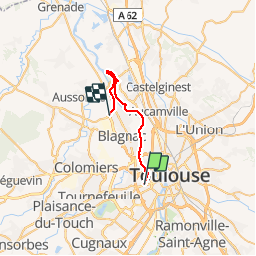
Trail Walking of 24 km to be discovered at Occitania, Haute-Garonne, Toulouse. This trail is proposed by RR31.
Description
Toulouse - Gagnac - Beauzelle
par la Rive Droite de la Garonne.
Chemin très nature presque toujours en bordure Garonne.
traversée à Gagnac par la passerelle de la Garonne.
Retour par le Tram de Beauzelle à Toulouse.
24,5 km de marche 30' de Tram.
repas au restaurant La Fontaine à Gagnac très bon menu 11,90 € excellent rapport qualité prix
Photos


Positioning
Comments