Trail Walking Nassogne - RB-LUX-07- Raccourci - En musardant entre Lhomme et Masblette, entre ri de Warlet et ruisseau de l’Hinson - Photo

RB-LUX-07- Raccourci - En musardant entre Lhomme et Masblette, entre ri de Warlet et ruisseau de l’Hinson

Randonnez sur et autour des GR ® wallons (Sentiers de Grande Randonnée). PRO

© OpenStreetMap contributors
Length
Length
20 km
Max alt
Max alt
423 m
Uphill gradient
Uphill gradient
680 m
Km-Effort
Km-Effort  
29 km
Min alt
Min alt
224 m
Downhill gradient
Downhill gradient
680 m
Boucle
Boucle
Yes
Creation date :
2019-08-07 07:27:14.453
Updated on :
2023-10-26 14:32:00.864

(3 Reviews)

Walking
Walking
6h00
Difficulty : Medium

Scan this QR Code to open this trail in the SityTrail application

FREE GPS app for hiking

Logo SityTrail SityTrail

IGN / Geographical institutes

Download SityTrail from the App Store Download SityTrail from Google Play

Logo SityTrail SityTrail World

The world is yours!

Download SityTrail from the App Store Download SityTrail from Google Play Download SityTrail on Huawei AppGallery

About

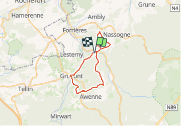
Trail Walking of 20 km to be discovered at Wallonia, Luxembourg, Nassogne. This trail is proposed by GR Rando.

Description

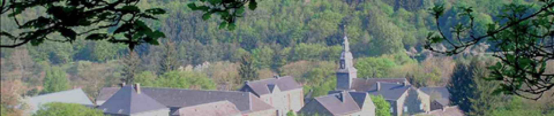
Masbourg, Mormont, Grupont, Masbourg, bois de la Haie Monon, Biermonfoy, Masbourg
Avertissement :
Cette rando-boucle est constituée de 2 boucles pour le parcours complet. Si vous désirez écourter la randonnée, la boucle sud représente environ 13 km, tandis que la Nord a une longueur de 9,5 km.
Cartographie et documentation :
Cartes IGN au 1 : 20 000, 59/3-4 « Rochefort – Nassogne » et 59/7-8 « Tellin – Saint-Hubert ».
Carte IGN au 1 : 25 000, « Au pays de Nassogne », carte de 23 promenades balisées – concepteur des itinéraires : Office communal du Tourisme de l’Entité de Nassogne, rue de Lahaut, 3 – 6950 Nassogne.
Carte IGN de promenades au 1 : 20 000 : « Au Pays de la Lesse et de la Lhomme – Commune de Tellin (Bure – Grupont – Resteigne – Tellin ) », éditeur responsable : Administration communale de Tellin, rue de la Libération, 45 – 6927 Tellin.
Topo-guide du GR 14 « Sentier de l’Ardenne (Malmedy – Bouillon – Sedan) ».
Où se restaurer et se désaltérer :
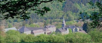
Une taverne à Grupont : « L’Ancienne Grange », 59c, rue Maréchal Foch – tél. 084 45 63 44 – 0474 55 74 77 (fermé le lundi et le mardi)
Au Fourneau Saint-Michel : une auberge et une cafétéria au musée de la Vie rurale et une autre cafétéria à proximité du musée du Fer. Autres possibilités, multiples bien sûr, à Saint-Hubert et le long de la N836 entre Rochefort et Marche-en- Famenne.

Photos

Points of interest

Point of interest Nassogne - Masbourg - Photo
GR Rando
NASSOGNE 
Point of interest Nassogne - Lieu-dit « L’Étoile » - Photo
GR Rando
Point of interest Tellin - Unnamed POI - Photo
GR Rando
TELLIN 
Point of interest Nassogne - Copette des Tiers - Photo
GR Rando
Point of interest Nassogne - Inzès Fochales - Photo
GR Rando
NASSOGNE 
Point of interest Nassogne - Biermonfoy - Photo
GR Rando
NASSOGNE 
Point of interest Tellin - Unnamed POI - Photo
GR Rando
TELLIN 

Positioning

Country:
Belgium
Region :
Wallonia
Department/Province :
Luxembourg
Municipality :
Nassogne
Location:
Unknown
Start:(UTM)
665306 ; 5553678 (31U) N.

Comments

Please log in to post a review or rate the element


très belle rando au calme.


Trails nearby

Trail Walking Tellin - GG-Lu-13_Grupont - Poix-Saint-Hubert - Photo
Walking
PRO

Walking

Very difficult
(2)
Tellin, Wallonia, Luxembourg, Belgium
26 km | 34 km-effort
7h 23min
No
Trail Walking Tellin - Balade à Grupont - Photo
Walking
GUIDE
Desrumaux

Walking

Easy
(1)
Tellin, Wallonia, Luxembourg, Belgium
8.4 km | 11.9 km-effort
2h 33min
Yes
Trail Walking Tellin - Bure - Promenade des chapelles - Photo
Walking
GUIDE+

Walking

Easy
(1)
Tellin, Wallonia, Luxembourg, Belgium
4.5 km | 5.9 km-effort
1h 15min
Yes
Trail Walking Tellin - Grupont - Promenade du Bois du Machi (EN) - Photo
Walking
GUIDE+

Walking

Medium
(1)
Tellin, Wallonia, Luxembourg, Belgium
8.6 km | 12.6 km-effort
2h 37min
Yes
Trail Walking Tellin - Bure - Promenade du pont des Clôyes - Photo
Walking
GUIDE+

Walking

Medium
(1)
Tellin, Wallonia, Luxembourg, Belgium
6.9 km | 9 km-effort
1h 59min
Yes
Trail Mountain bike Nassogne - Nassogne - Circuit VTT rouge 4 - Photo
Mountain bike
GUIDE+

Mountain bike

Difficult
(1)
Nassogne, Wallonia, Luxembourg, Belgium
26 km | 36 km-effort
2h 16min
Yes
Trail Walking Nassogne - Forrières/Lesterny - Promenade Saint-Martin (NG 08) - Photo
Walking
GUIDE+

Walking

Medium
(4)
Nassogne, Wallonia, Luxembourg, Belgium
7.3 km | 9 km-effort
1h 57min
Yes
Trail Walking Nassogne - Forrières - Promenade de Cocher (NG 07) - Photo
Walking
GUIDE+

Walking

Medium
(2)
Nassogne, Wallonia, Luxembourg, Belgium
5.4 km | 6.7 km-effort
1h 28min
Yes
Trail Walking Nassogne - Ambly - Promenade de Javingue (NG 02) - Photo
Walking
GUIDE+

Walking

Medium
(7)
Nassogne, Wallonia, Luxembourg, Belgium
9 km | 11.6 km-effort
2h 28min
Yes


Close
My subscriptions