


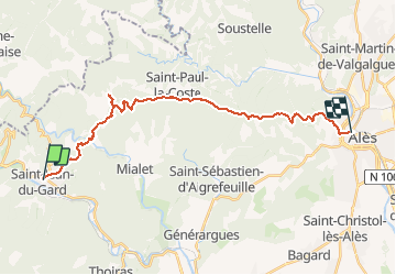
GR70_St_Jean_du_Gard - ALES

svp59
User

Length
24 km

Max alt
667 m

Uphill gradient
974 m
Km-Effort
37 km

Min alt
129 m

Downhill gradient
1031 m
Boucle
No
Creation date :
2014-12-10 00:00:00.0
Updated on :
2014-12-10 00:00:00.0
7h46
Difficulty : Difficult

FREE GPS app for hiking
 SityTrail
IGN / Geographical institutes
SityTrail Plus
The world is yours!
About
Trail Walking of 24 km to be discovered at Occitania, Gard, Saint-Jean-du-Gard. This trail is proposed by svp59.
Positioning
Country:
France
Region :
Occitania
Department/Province :
Gard
Municipality :
Saint-Jean-du-Gard
Location:
Unknown
Start:(Dec)
Start:(UTM)
570889 ; 4884077 (31T) N.
Comments