ensues

mhetpierre
User

Length
11.7 km

Max alt
134 m

Uphill gradient
302 m
Km-Effort
15.7 km

Min alt
9 m

Downhill gradient
302 m
Boucle
Yes
Creation date :
2018-08-18 15:31:17.318
Updated on :
2018-08-18 15:31:17.318
3h22
Difficulty : Easy

FREE GPS app for hiking
 SityTrail
IGN / Geographical institutes
SityTrail Plus
The world is yours!
About
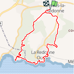
Trail Walking of 11.7 km to be discovered at Provence-Alpes-Côte d'Azur, Bouches-du-Rhône, Ensuès-la-Redonne. This trail is proposed by mhetpierre.
Description
ensues
Positioning
Country:
France
Region :
Provence-Alpes-Côte d'Azur
Department/Province :
Bouches-du-Rhône
Municipality :
Ensuès-la-Redonne
Location:
Unknown
Start:(Dec)
Start:(UTM)
678314 ; 4802500 (31T) N.
Comments