


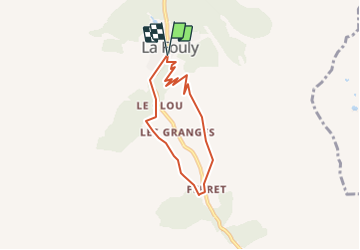
Fouly-Ferret

Dgubler
User

Length
5.6 km

Max alt
1844 m

Uphill gradient
265 m
Km-Effort
9.1 km

Min alt
1599 m

Downhill gradient
255 m
Boucle
Yes
Creation date :
2014-12-11 00:00:00.0
Updated on :
2014-12-11 00:00:00.0
--
Difficulty : Unknown

FREE GPS app for hiking
 SityTrail
IGN / Geographical institutes
SityTrail Plus
The world is yours!
About
Trail Other activity of 5.6 km to be discovered at Valais/Wallis, Entremont, Orsières. This trail is proposed by Dgubler.
Description
Promenade de l''Aigle selon www.st-bernard.ch. Nous l''avons faite à partir de Ferret le 10 mai 2008. Encore pas mal de neige...
On voit des tussilages et diverses variétés de gentianes.
Positioning
Country:
Switzerland
Region :
Valais/Wallis
Department/Province :
Entremont
Municipality :
Orsières
Location:
Unknown
Start:(Dec)
Start:(UTM)
352604 ; 5088260 (32T) N.
Comments