


LE PUY LE BOUCHET via GR700

svp59
User
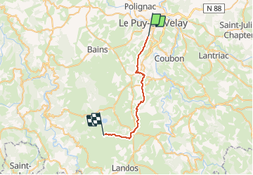

Length
25 km

Max alt
1220 m

Uphill gradient
838 m
Km-Effort
35 km

Min alt
657 m

Downhill gradient
279 m
Boucle
No
Creation date :
2014-12-10 00:00:00.0
Updated on :
2014-12-10 00:00:00.0
7h39
Difficulty : Medium

FREE GPS app for hiking
 SityTrail
IGN / Geographical institutes
SityTrail Plus
The world is yours!
About
Trail Walking of 25 km to be discovered at Auvergne-Rhône-Alpes, Haute-Loire, Vals-près-le-Puy. This trail is proposed by svp59.
Positioning
Country:
France
Region :
Auvergne-Rhône-Alpes
Department/Province :
Haute-Loire
Municipality :
Vals-près-le-Puy
Location:
Unknown
Start:(Dec)
Start:(UTM)
569036 ; 4986277 (31T) N.
Comments
Balade sympa avec pas mal de chemins. Rando faite avec VTT AE.