


Puy de la Vache

Chapatann
User

Length
2.6 km

Max alt
1150 m

Uphill gradient
171 m
Km-Effort
4.8 km

Min alt
984 m

Downhill gradient
157 m
Boucle
No
Creation date :
2014-12-10 00:00:00.0
Updated on :
2014-12-10 00:00:00.0
58m
Difficulty : Medium

FREE GPS app for hiking
 SityTrail
IGN / Geographical institutes
SityTrail Plus
The world is yours!
About
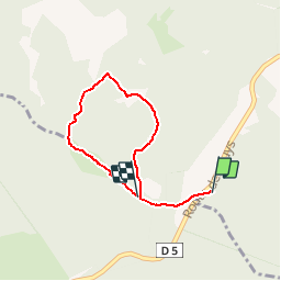
Trail Walking of 2.6 km to be discovered at Auvergne-Rhône-Alpes, Puy-de-Dôme, Saint-Genès-Champanelle. This trail is proposed by Chapatann.
Description
Randonnée découverte du puy de la vache
Positioning
Country:
France
Region :
Auvergne-Rhône-Alpes
Department/Province :
Puy-de-Dôme
Municipality :
Saint-Genès-Champanelle
Location:
Unknown
Start:(Dec)
Start:(UTM)
497472 ; 5060869 (31T) N.
Comments