


Ménilles - sentier de découverte

marcel.F
User

Length
10.2 km

Max alt
136 m

Uphill gradient
179 m
Km-Effort
12.6 km

Min alt
35 m

Downhill gradient
176 m
Boucle
Yes
Creation date :
2014-12-10 00:00:00.0
Updated on :
2014-12-10 00:00:00.0
2h41
Difficulty : Easy

FREE GPS app for hiking
 SityTrail
IGN / Geographical institutes
SityTrail Plus
The world is yours!
About
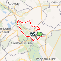
Trail Walking of 10.2 km to be discovered at Normandy, Eure, Ménilles. This trail is proposed by marcel.F.
Description
Boucle au départ mairie de Ménilles
parcours homologué CAPE - balisage jaune
Positioning
Country:
France
Region :
Normandy
Department/Province :
Eure
Municipality :
Ménilles
Location:
Unknown
Start:(Dec)
Start:(UTM)
380657 ; 5432393 (31U) N.
Comments
randonnée agréable