Trail Other activity Vuadens - Niremont - (Bulle - Les  Paccots) - Photo

Niremont - (Bulle - Les Paccots)

 Romrando
Romrando

User

© OpenStreetMap contributors
Length
Length
13.8 km
Max alt
Max alt
1505 m
Uphill gradient
Uphill gradient
878 m
Km-Effort
Km-Effort  
25 km
Min alt
Min alt
803 m
Downhill gradient
Downhill gradient
618 m
Boucle
Boucle
No
Creation date :
2014-12-11 00:00:00.0
Updated on :
2014-12-11 00:00:00.0

(0 Reviews)

Other activity
Other activity
--
Difficulty : Unknown

Scan this QR Code to open this trail in the SityTrail application

FREE GPS app for hiking

Logo SityTrail SityTrail

IGN / Geographical institutes

Download SityTrail from the App Store Download SityTrail from Google Play

Logo SityTrail SityTrail World

The world is yours!

Download SityTrail from the App Store Download SityTrail from Google Play Download SityTrail on Huawei AppGallery

About

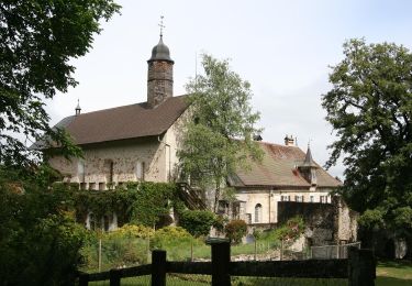
Trail Other activity of 13.8 km to be discovered at Fribourg, Gruyère District, Vuadens. This trail is proposed by Romrando.

Description

Source:geocities.com/romrando

Superbe plateau méconnu. Ambiance très nordique. Beau coup d''oeil sur le Moléson. A pratiquer absolument par lendemain de bonne chute de neige ! C''est splendide !

Circuit : Parquer la voiture à Châtel-St-Denis puis en train jusqu''à la halte des Colombettes peu après Vaulruz. Des Paccots, retour en car jusqu''à Châtel.

Depuis la halte des "Les Colombettes" suivre la petite route qui part au sud. Au premier carrefour poursuivre tout droit direction "Les Portes". Remonter la route qui serpente un peu puis quand elle part franchement à droite poursuive tout droit en forêt par un chemin qui longe un ruisseau. Il vous amène plus haut après un S, dans un pâturage que l''on remonte alors directement vers "Les Portes d''en Haut".


Vers l''W puis le SW on longe la crête des Alpettes à travers bois avant de déboucher sur la "Queue des Alpettes". Suivre la crête dénudée jusqu''au sommet des Alpettes puis descendre droit au S et franchir la dépression. Gagner vers le SE la "Goille au Cerf".

On traverse alors un morceau de Laponie, où les sapins nains alternent avec les bouleaux. Pour parvenir au sommet du Niremont, on se faufilera dans un dédale de sapelots avant de traverser un grand plateau dominé au sud par le sommet peu marqué du "Grand Niremont".  


Decente sur Les Paccots : vers le SW rejoindre le "Petit Niremont" puis droit au S vers la route et le chalet de "La Frasse". Prendre vers le ESE le petit chemin qui vous mène au fond du vallon profond où l''on franchit la Veveyse de Châtel. On remonte alors vers Les Paccots

Elevation profile

Positioning

Country:
Switzerland
Region :
Fribourg
Department/Province :
Gruyère District
Municipality :
Vuadens
Location:
Unknown
Start:(UTM)
346958 ; 5164524 (32T) N.

Trails nearby

Trail Walking Bulle - Broc FR - Notre Dame des Marches - Photo
Walking
furggstalden

Walking

Very easy
(1)
Bulle, Fribourg, Gruyère District, Switzerland
14.3 km | 19.7 km-effort
4h 37min
Yes
Trail On foot Gruyères - Sentier des Pauvres - Photo
On foot
PRO

On foot

Easy
Gruyères, Fribourg, Gruyère District, Switzerland
5.9 km | 8.5 km-effort
1h 55min
No
Trail Walking Riaz - Riaz - Marsens - L'Abbaye - Photo
Walking
gpiller

Walking

Very easy
Riaz, Fribourg, Gruyère District, Switzerland
8 km | 10.8 km-effort
2h 30min
Yes
Trail Cycle Vaulruz - le gros de Vaud - Photo
Cycle
pawenger

Cycle

Very easy
Vaulruz, Fribourg, Gruyère District, Switzerland
67 km | 85 km-effort
3h 17min
Yes
Trail Mountain bike Vaulruz - La Queue des Alpettes - Photo
Mountain bike
ce_l

Mountain bike

Medium
Vaulruz, Fribourg, Gruyère District, Switzerland
14.1 km | 22 km-effort
Unknown
Yes
Trail Other activity Bulle - Ascension_09_2 - Photo
Other activity
pierrepraz

Other activity

Very easy
Bulle, Fribourg, Gruyère District, Switzerland
18.7 km | 27 km-effort
Unknown
No
Trail Mountain bike Riaz - VTT Riaz-Monts-ChaletNeuf-Maules-Monts-Riaz - Photo
Mountain bike
lapoya

Mountain bike

Very easy
Riaz, Fribourg, Gruyère District, Switzerland
19.9 km | 28 km-effort
1h 30min
No
Trail Other activity Bulle - Trail 2009/02/04 18:02 - Photo
Other activity
illan

Other activity

Very easy
Bulle, Fribourg, Gruyère District, Switzerland
3.4 km | 4.2 km-effort
46min
Yes
Trail Other activity Bulle - JW Bulle-Oron - Photo
Other activity
Regli

Other activity

Very easy
Bulle, Fribourg, Gruyère District, Switzerland
4 km | 5.7 km-effort
Unknown
No


Close
My subscriptions