


Haute Cîme

pnoth
User
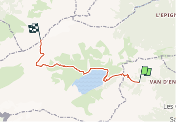

Length
10 km

Max alt
3254 m

Uphill gradient
1859 m
Km-Effort
29 km

Min alt
1386 m

Downhill gradient
25 m
Boucle
No
Creation date :
2014-12-11 00:00:00.0
Updated on :
2014-12-11 00:00:00.0
--
Difficulty : Unknown

FREE GPS app for hiking
 SityTrail
IGN / Geographical institutes
SityTrail Plus
The world is yours!
About
Trail Other activity of 10 km to be discovered at Valais/Wallis, Saint-Maurice, Salvan. This trail is proposed by pnoth.
Description
English: http://www.noth.ch/h0102_e.html
Français: http://www.noth.ch/h0102_f.html
Deutsch: http://www.noth.ch/h0102_d.html
Positioning
Country:
Switzerland
Region :
Valais/Wallis
Department/Province :
Saint-Maurice
Municipality :
Salvan
Location:
Unknown
Start:(Dec)
Start:(UTM)
344958 ; 5111580 (32T) N.
Comments