


Rejus Pic de Ladenne

staubalex
User
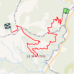

Length
9.2 km

Max alt
884 m

Uphill gradient
604 m
Km-Effort
15.6 km

Min alt
392 m

Downhill gradient
136 m
Boucle
No
Creation date :
2014-12-10 00:00:00.0
Updated on :
2014-12-10 00:00:00.0
1h09
Difficulty : Difficult

FREE GPS app for hiking
 SityTrail
IGN / Geographical institutes
SityTrail Plus
The world is yours!
About
Trail Mountain bike of 9.2 km to be discovered at Auvergne-Rhône-Alpes, Ardèche, Meyras. This trail is proposed by staubalex.
Positioning
Country:
France
Region :
Auvergne-Rhône-Alpes
Department/Province :
Ardèche
Municipality :
Meyras
Location:
Unknown
Start:(Dec)
Start:(UTM)
600444 ; 4946278 (31T) N.
Comments