Trail Cycle Peyruis - Lure en boucle de peyruis - Photo
 zapi
zapi

User

© OpenStreetMap contributors
Length
Length
65 km
Max alt
Max alt
1747 m
Uphill gradient
Uphill gradient
1767 m
Km-Effort
Km-Effort  
88 km
Min alt
Min alt
413 m
Downhill gradient
Downhill gradient
1767 m
Boucle
Boucle
Yes
Creation date :
2014-12-10 00:00:00.0
Updated on :
2014-12-10 00:00:00.0

(0 Reviews)

Cycle
Cycle
5h04
Difficulty : Difficult

Scan this QR Code to open this trail in the SityTrail application

FREE GPS app for hiking

Logo SityTrail SityTrail

IGN / Geographical institutes

Download SityTrail from the App Store Download SityTrail from Google Play

Logo SityTrail SityTrail World

The world is yours!

Download SityTrail from the App Store Download SityTrail from Google Play Download SityTrail on Huawei AppGallery

About

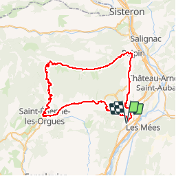
Trail Cycle of 65 km to be discovered at Provence-Alpes-Côte d'Azur, Alpes-de-Haute-Provence, Peyruis. This trail is proposed by zapi.

Description

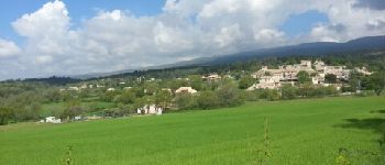
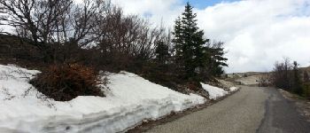
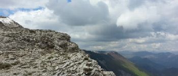
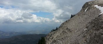
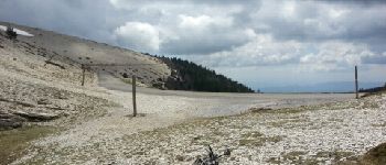
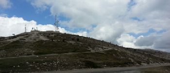
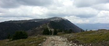
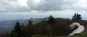
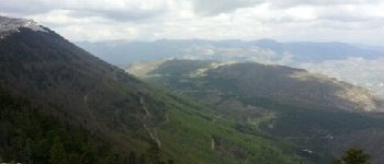
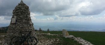
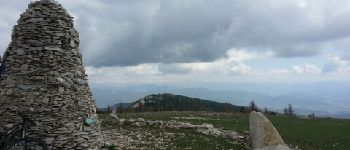
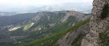
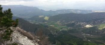
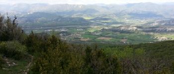
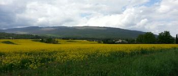
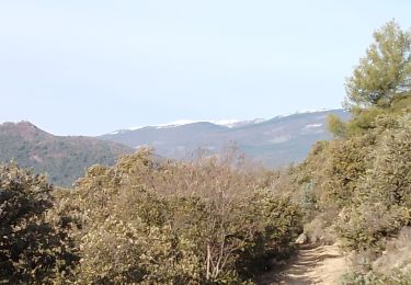
La montagne de Lure avec panorama magique sur la crête de Lure!!!
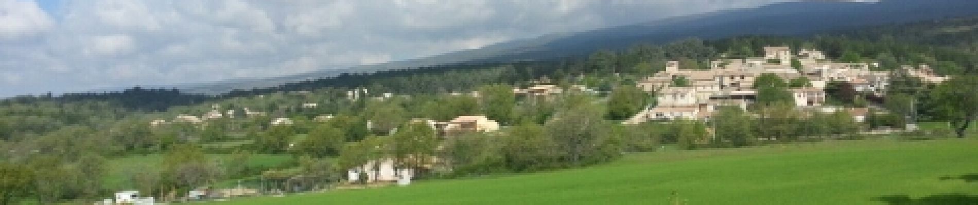
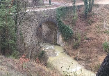
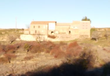
C'est un circuit qui mix la route et les single VTT, départ de peyruis pour rejoindre malfougasse par la piste, puis on prends la route qui monte au sommet de Lure en passant par st Étienne les orgues, du pas de la graille on quitte la route pour prendre pied sur la crête de Lure qui mène jusqu'à Volonne et retour par la route jusqu'à Peyruis.
         

Elevation profile

Photos

Points of interest

Point of interest Mallefougasse-Augès - Malfougasse - Photo
zapi
MALLEFOUGASSE-AUGÈS 
Point of interest Saint-Étienne-les-Orgues - Dans l'ascension de lure - Photo
zapi
SAINT-ÉTIENNE-LES-ORGUES 
Point of interest Saint-Étienne-les-Orgues - Crête de Lure - Photo
zapi
SAINT-ÉTIENNE-LES-ORGUES 
Point of interest Noyers-sur-Jabron - Crête de Lure - Photo
zapi
NOYERS-SUR-JABRON 
Point of interest Noyers-sur-Jabron - Route qui mène au sommet - Photo
zapi
NOYERS-SUR-JABRON 
Point of interest Saint-Étienne-les-Orgues - Summit de Lure - Photo
zapi
SAINT-ÉTIENNE-LES-ORGUES 
Point of interest Saint-Étienne-les-Orgues - vue sur le pas de la graille - Photo
zapi
SAINT-ÉTIENNE-LES-ORGUES 
Point of interest Valbelle - Crête de lure - Photo
zapi
VALBELLE 
Point of interest Valbelle - Vallée du jabron - Photo
zapi
Point of interest Cruis - Cairn 2000 - Photo
zapi
CRUIS 
Point of interest Cruis - cairn 2000 - Photo
zapi
CRUIS 
Point of interest Valbelle - suite de la crête  - Photo
zapi
Point of interest Peipin - descente - Photo
zapi
PEIPIN 
Point of interest Peipin - Val de Durance - Photo
zapi
Point of interest Châteauneuf-Val-Saint-Donat - vue sur la crête de Lure - Photo
zapi
CHÂTEAUNEUF-VAL-SAINT-DONAT 

Positioning

Country:
France
Region :
Provence-Alpes-Côte d'Azur
Department/Province :
Alpes-de-Haute-Provence
Municipality :
Peyruis
Location:
Unknown
Start:(UTM)
735815 ; 4880016 (31T) N.

Trails nearby

Trail Walking Les Mées - Les Mées - Malijai - Les Mées - Photo
Walking
tracegps

Walking

Medium
(1)
Les Mées, Provence-Alpes-Côte d'Azur, Alpes-de-Haute-Provence, France
12.1 km | 18.1 km-effort
4h 30min
Yes
Trail Walking Les Mées - Les Pénitents - circuit long - Les Mées - Photo
Walking
tracegps

Walking

Medium
(1)
Les Mées, Provence-Alpes-Côte d'Azur, Alpes-de-Haute-Provence, France
14.3 km | 21 km-effort
4h 0min
Yes
Trail Walking Les Mées - Les Pénitents - circuit court - Les Mées - Photo
Walking
tracegps

Walking

Medium
(2)
Les Mées, Provence-Alpes-Côte d'Azur, Alpes-de-Haute-Provence, France
5.8 km | 9.5 km-effort
2h 0min
Yes
Trail Walking Ganagobie - Plateau de Ganagobie - Photo
Walking
tracegps

Walking

Medium
(2)
Ganagobie, Provence-Alpes-Côte d'Azur, Alpes-de-Haute-Provence, France
7.6 km | 10.9 km-effort
3h 0min
Yes
Trail Walking Les Mées - 2023-04-14 Les Apollinaires- Haute montagne - Les Pénitents  - Photo
Walking
GUIDE
Kargil

Walking

Medium
Les Mées, Provence-Alpes-Côte d'Azur, Alpes-de-Haute-Provence, France
17.5 km | 26 km-effort
5h 49min
Yes
Trail Running Peyruis - trail 29 07 2013 - Photo
Running
zapi

Running

Medium
(1)
Peyruis, Provence-Alpes-Côte d'Azur, Alpes-de-Haute-Provence, France
13.5 km | 20 km-effort
1h 27min
Yes
Trail Walking Ganagobie - 2024-02-27 Ganagobie  - Photo
Walking
GUIDE
Kargil

Walking

Easy
Ganagobie, Provence-Alpes-Côte d'Azur, Alpes-de-Haute-Provence, France
10.2 km | 15.1 km-effort
3h 25min
Yes
Trail Walking Les Mées - les mees . oratoire Saint Antoine.  - Photo
Walking
Roger

Walking

Easy
Les Mées, Provence-Alpes-Côte d'Azur, Alpes-de-Haute-Provence, France
8 km | 10 km-effort
2h 32min
Yes
Trail Walking Les Mées - les mees . Apollinaire par le sentier des oliviers  - Photo
Walking
Roger

Walking

Medium
Les Mées, Provence-Alpes-Côte d'Azur, Alpes-de-Haute-Provence, France
10.3 km | 14.7 km-effort
3h 10min
Yes


Close
My subscriptions