


Nantes à Clisson

vsellier
User
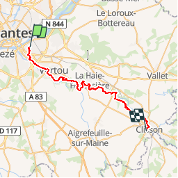

Length
35 km

Max alt
46 m

Uphill gradient
407 m
Km-Effort
40 km

Min alt
2 m

Downhill gradient
385 m
Boucle
No
Creation date :
2014-12-10 00:00:00.0
Updated on :
2014-12-10 00:00:00.0
--
Difficulty : Unknown

FREE GPS app for hiking
 SityTrail
IGN / Geographical institutes
SityTrail Plus
The world is yours!
About
Trail Walking of 35 km to be discovered at Pays de la Loire, Loire-Atlantique, Saint-Sébastien-sur-Loire. This trail is proposed by vsellier.


Positioning
Country:
France
Region :
Pays de la Loire
Department/Province :
Loire-Atlantique
Municipality :
Saint-Sébastien-sur-Loire
Location:
Unknown
Start:(Dec)
Start:(UTM)
612371 ; 5228315 (30T) N.
Comments