


ruisseau arles colombieres

yt34
User

Length
13.9 km

Max alt
1050 m

Uphill gradient
896 m
Km-Effort
26 km

Min alt
218 m

Downhill gradient
928 m
Boucle
Yes
Creation date :
2014-12-10 00:00:00.0
Updated on :
2014-12-10 00:00:00.0
5h19
Difficulty : Difficult

FREE GPS app for hiking
 SityTrail
IGN / Geographical institutes
SityTrail Plus
The world is yours!
About
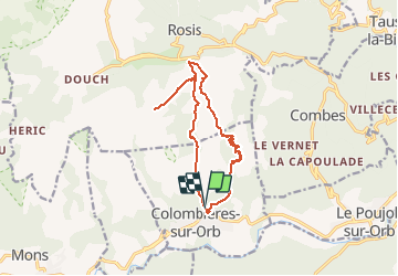
Trail Walking of 13.9 km to be discovered at Occitania, Hérault, Colombières-sur-Orb. This trail is proposed by yt34.
Positioning
Country:
France
Region :
Occitania
Department/Province :
Hérault
Municipality :
Colombières-sur-Orb
Location:
Unknown
Start:(Dec)
Start:(UTM)
500883 ; 4825473 (31T) N.
Comments