


2013-05-10 Marche Rocher de Mutzig par Nideck

holtzv
User GUIDE
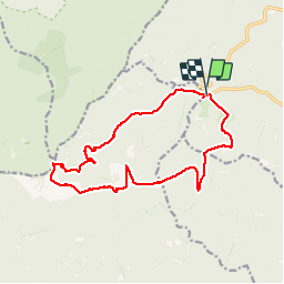

Length
14.9 km

Max alt
1000 m

Uphill gradient
646 m
Km-Effort
24 km

Min alt
390 m

Downhill gradient
652 m
Boucle
Yes
Creation date :
2014-12-10 00:00:00.0
Updated on :
2014-12-10 00:00:00.0
4h10
Difficulty : Medium

FREE GPS app for hiking
 SityTrail
IGN / Geographical institutes
SityTrail Plus
The world is yours!
About
Trail Walking of 14.9 km to be discovered at Grand Est, Bas-Rhin, Lutzelhouse. This trail is proposed by holtzv.
Positioning
Country:
France
Region :
Grand Est
Department/Province :
Bas-Rhin
Municipality :
Lutzelhouse
Location:
Unknown
Start:(Dec)
Start:(UTM)
372163 ; 5380955 (32U) N.
Comments
Belle ballade avec cependant une petite portion très sauvage, pour ainsi dire hors sentier, après 3 km environ. Le dénivelé de 3.000 m est bien entendu erroné , il doit y avoir environ 600 à 700 m.