


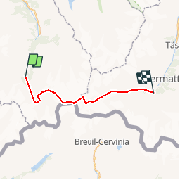
Arolla - Bertol - Tête Blanche - Zermatt GC

chalet
User

Length
26 km

Max alt
3725 m

Uphill gradient
1982 m
Km-Effort
53 km

Min alt
1845 m

Downhill gradient
2129 m
Boucle
No
Creation date :
2014-12-11 00:00:00.0
Updated on :
2014-12-11 00:00:00.0
--
Difficulty : Unknown

FREE GPS app for hiking
 SityTrail
IGN / Geographical institutes
SityTrail Plus
The world is yours!
About
Trail Other activity of 26 km to be discovered at Valais/Wallis, Hérens, Evolène. This trail is proposed by chalet.
Description
Arolla - nuit à la cabane Bertol -
Tête Blanche 3710 m - Stockjigletscher -Z''Muttgletscher et Zermatt
En passant...on peut vite aller à la Tête de Valpelline 3799 m.
Positioning
Country:
Switzerland
Region :
Valais/Wallis
Department/Province :
Hérens
Municipality :
Evolène
Location:
Unknown
Start:(Dec)
Start:(UTM)
382461 ; 5097993 (32T) N.
Comments