


contadour

Michel07
User
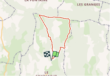

Length
13.6 km

Max alt
1428 m

Uphill gradient
386 m
Km-Effort
18.7 km

Min alt
1206 m

Downhill gradient
384 m
Boucle
Yes
Creation date :
2014-12-10 00:00:00.0
Updated on :
2014-12-10 00:00:00.0
4h03
Difficulty : Medium

FREE GPS app for hiking
 SityTrail
IGN / Geographical institutes
SityTrail Plus
The world is yours!
About
Trail Walking of 13.6 km to be discovered at Provence-Alpes-Côte d'Azur, Alpes-de-Haute-Provence, Redortiers. This trail is proposed by Michel07.
Positioning
Country:
France
Region :
Provence-Alpes-Côte d'Azur
Department/Province :
Alpes-de-Haute-Provence
Municipality :
Redortiers
Location:
Unknown
Start:(Dec)
Start:(UTM)
710029 ; 4888033 (31T) N.
Comments