Trail Mountain bike Cavillargues - Randonnée autour de Cavillargues - Photo

Randonnée autour de Cavillargues

 tracegps
tracegps

User

© OpenStreetMap contributors
Length
Length
17.8 km
Max alt
Max alt
242 m
Uphill gradient
Uphill gradient
368 m
Km-Effort
Km-Effort  
23 km
Min alt
Min alt
119 m
Downhill gradient
Downhill gradient
367 m
Boucle
Boucle
Yes
Creation date :
2014-12-10 00:00:00.0
Updated on :
2014-12-10 00:00:00.0

(0 Reviews)

Mountain bike
Mountain bike
2h00
Difficulty : Medium

Scan this QR Code to open this trail in the SityTrail application

FREE GPS app for hiking

Logo SityTrail SityTrail

IGN / Geographical institutes

Download SityTrail from the App Store Download SityTrail from Google Play

Logo SityTrail SityTrail World

The world is yours!

Download SityTrail from the App Store Download SityTrail from Google Play Download SityTrail on Huawei AppGallery

About

Trail Mountain bike of 17.8 km to be discovered at Occitania, Gard, Cavillargues. This trail is proposed by tracegps.

Description

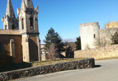
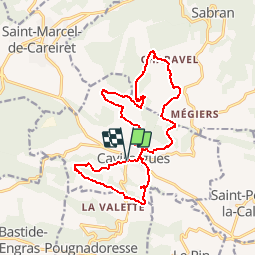
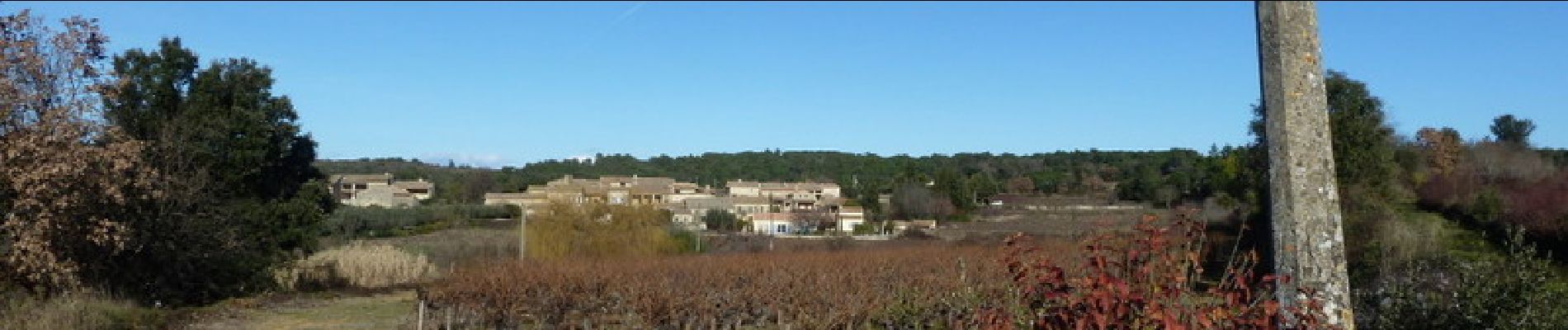
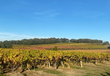
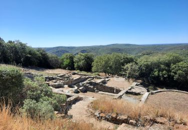
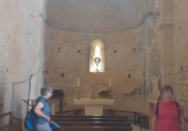
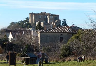
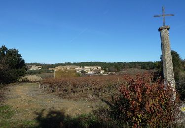
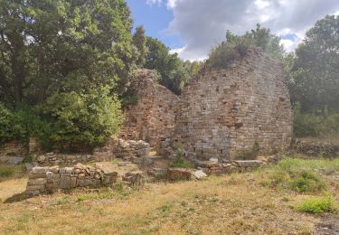
Voici deux boucles au départ de Cavillargues, la plus courte au sud (6.5km) et l'autre au nord (11km). Départ du "parking des randonneurs". Coin pique-nique possible, à la chapelle St Sépulcre. En chemin la chapelle st sépulcre, quelques croix et le moulin d'Auzigue, ainsi qu'un parcours forestier. Rando facile sur de bons chemins, quelques beaux lavoirs à visiter en cours de route. Bonne balade.

Elevation profile

Photos

Positioning

Country:
France
Region :
Occitania
Department/Province :
Gard
Municipality :
Cavillargues
Location:
Unknown
Start:(UTM)
621475 ; 4885671 (31T) N.

Trails nearby

Trail Walking Cavillargues - Cavillargues  - Photo
Walking
GUIDE
Roger Philippe Wallez

Walking

Very difficult
Cavillargues, Occitania, Gard, France
22 km | 27 km-effort
7h 2min
Yes
Trail Walking Le Pin - Le pin , la Garbie et oppidum - Photo
Walking
jcguew

Walking

Medium
Le Pin, Occitania, Gard, France
6.3 km | 8.3 km-effort
2h 42min
No
Trail Walking Sabran - Sabran marche vigneronne - Photo
Walking
poisson1103

Walking

Medium
Sabran, Occitania, Gard, France
14.3 km | 19.1 km-effort
3h 27min
Yes
Trail Other activity Saint-Laurent-la-Vernède - Saint Laurent la Vernède - Photo
Other activity
cpiton

Other activity

Very easy
Saint-Laurent-la-Vernède, Occitania, Gard, France
21 km | 24 km-effort
2h 48min
No
Trail Mountain bike La Bastide-d'Engras - Chapelle St-Jean - La Bastide d'Engras - Photo
Mountain bike
tracegps

Mountain bike

Medium
La Bastide-d'Engras, Occitania, Gard, France
17.6 km | 21 km-effort
2h 0min
Yes
Trail Walking La Bastide-d'Engras - Chapelle St-Jean - La Bastide d'Engras - Photo
Walking
tracegps

Walking

Difficult
La Bastide-d'Engras, Occitania, Gard, France
17.6 km | 21 km-effort
4h 30min
Yes
Trail Walking Cavillargues - Randonnée autour de Cavillargues - Photo
Walking
tracegps

Walking

Medium
Cavillargues, Occitania, Gard, France
17.8 km | 23 km-effort
5h 0min
Yes
Trail Walking Gaujac - Gaujac - Oppidum - Photo
Walking
rando30129

Walking

Difficult
Gaujac, Occitania, Gard, France
11.2 km | 14.3 km-effort
2h 59min
Yes
Trail Walking Cavillargues - cavillargues - Photo
Walking
Altet

Walking

Medium
Cavillargues, Occitania, Gard, France
19 km | 24 km-effort
4h 25min
Yes


Close
My subscriptions