Trail Walking Botmeur - Roc'h Bichourel - Botmeur - Photo

Roc'h Bichourel - Botmeur

 tracegps
tracegps

User

© OpenStreetMap contributors
Length
Length
8.3 km
Max alt
Max alt
358 m
Uphill gradient
Uphill gradient
146 m
Km-Effort
Km-Effort  
10.2 km
Min alt
Min alt
249 m
Downhill gradient
Downhill gradient
143 m
Boucle
Boucle
Yes
Creation date :
2014-12-10 00:00:00.0
Updated on :
2014-12-10 00:00:00.0

(0 Reviews)

Walking
Walking
2h30
Difficulty : Medium

Scan this QR Code to open this trail in the SityTrail application

FREE GPS app for hiking

Logo SityTrail SityTrail

IGN / Geographical institutes

Download SityTrail from the App Store Download SityTrail from Google Play

Logo SityTrail SityTrail World

The world is yours!

Download SityTrail from the App Store Download SityTrail from Google Play Download SityTrail on Huawei AppGallery

About

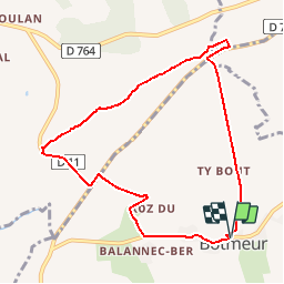
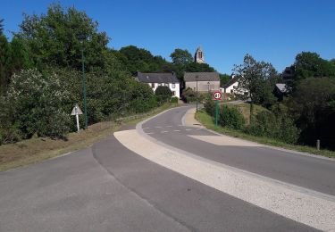
Trail Walking of 8.3 km to be discovered at Brittany, Finistère, Botmeur. This trail is proposed by tracegps.

Description

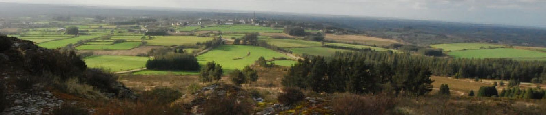
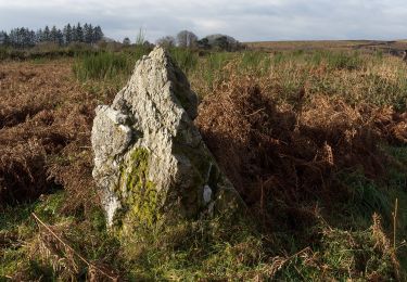
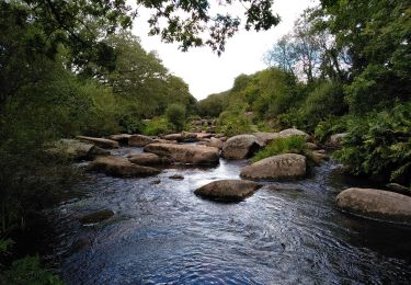
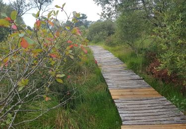
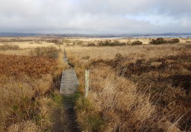
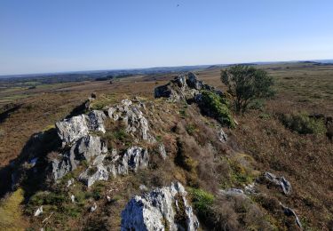
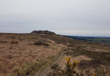
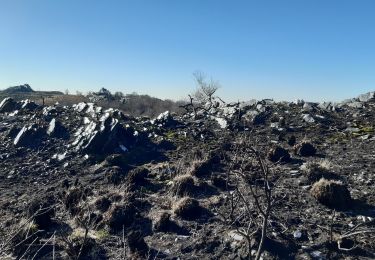
Un circuit au cœur des Monts d'Arrée. Au programme, les landes, les bruyères, les points de vues, les rochers de schiste...... pour cette rando.

Elevation profile

Photos

Positioning

Country:
France
Region :
Brittany
Department/Province :
Finistère
Municipality :
Botmeur
Location:
Unknown
Start:(UTM)
432190 ; 5359324 (30U) N.

Trails nearby

Trail On foot Saint-Rivoal - Landes et Tourbières - Photo
On foot
PRO

On foot

Easy
Saint-Rivoal, Brittany, Finistère, France
11.8 km | 14.1 km-effort
3h 12min
No
Trail On foot Botmeur - Brasparts Circuit des landes et tourbières - Photo
On foot
PRO

On foot

Easy
Botmeur, Brittany, Finistère, France
3.7 km | 4.2 km-effort
57min
No
Trail Walking Brennilis - BRENNILIS - Photo
Walking
RonanDAGORN

Walking

Medium
Brennilis, Brittany, Finistère, France
22 km | 28 km-effort
5h 10min
Yes
Trail Walking Brennilis - GR_37_EE_11_Brennilis_St-Rivoal_20200810 - Photo
Walking
patrickdanilo

Walking

Easy
Brennilis, Brittany, Finistère, France
21 km | 25 km-effort
5h 49min
No
Trail Walking La Feuillée - La Feuillée - Huelgoat - Lac St Michel - Photo
Walking
olibreizh

Walking

Medium
La Feuillée, Brittany, Finistère, France
47 km | 56 km-effort
11h 3min
Yes
Trail Walking Commana - Circuit de la pierre bleue - Commana - Photo
Walking
tracegps

Walking

Medium
Commana, Brittany, Finistère, France
15.7 km | 19.7 km-effort
4h 30min
Yes
Trail Walking La Feuillée - 2023-10-08 Roc'h trévezel - Roc'h ruz  - Photo
Walking
jacq58

Walking

Very easy
La Feuillée, Brittany, Finistère, France
6.3 km | 7.4 km-effort
1h 33min
Yes
Trail Walking La Feuillée - Roc'h 'n Roc'h - Photo
Walking
neleda

Walking

Difficult
La Feuillée, Brittany, Finistère, France
12.9 km | 15.5 km-effort
3h 14min
Yes
Trail Walking Commana - Maugau Bihan - Photo
Walking
Fky78

Walking

Medium
(1)
Commana, Brittany, Finistère, France
8.9 km | 11.4 km-effort
2h 35min
Yes


Close
My subscriptions