Trail Walking Arras-en-Lavedan - Le Pouy Droumide par Sireix - Photo

Le Pouy Droumide par Sireix

 tracegps
tracegps

User

© OpenStreetMap contributors
Length
Length
13.5 km
Max alt
Max alt
1718 m
Uphill gradient
Uphill gradient
716 m
Km-Effort
Km-Effort  
23 km
Min alt
Min alt
1155 m
Downhill gradient
Downhill gradient
710 m
Boucle
Boucle
Yes
Creation date :
2014-12-10 00:00:00.0
Updated on :
2014-12-10 00:00:00.0

(0 Reviews)

Walking
Walking
5h19
Difficulty : Medium

Scan this QR Code to open this trail in the SityTrail application

FREE GPS app for hiking

Logo SityTrail SityTrail

IGN / Geographical institutes

Download SityTrail from the App Store Download SityTrail from Google Play

Logo SityTrail SityTrail World

The world is yours!

Download SityTrail from the App Store Download SityTrail from Google Play Download SityTrail on Huawei AppGallery

About

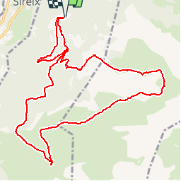
Trail Walking of 13.5 km to be discovered at Occitania, Hautespyrenees, Arras-en-Lavedan. This trail is proposed by tracegps.

Description

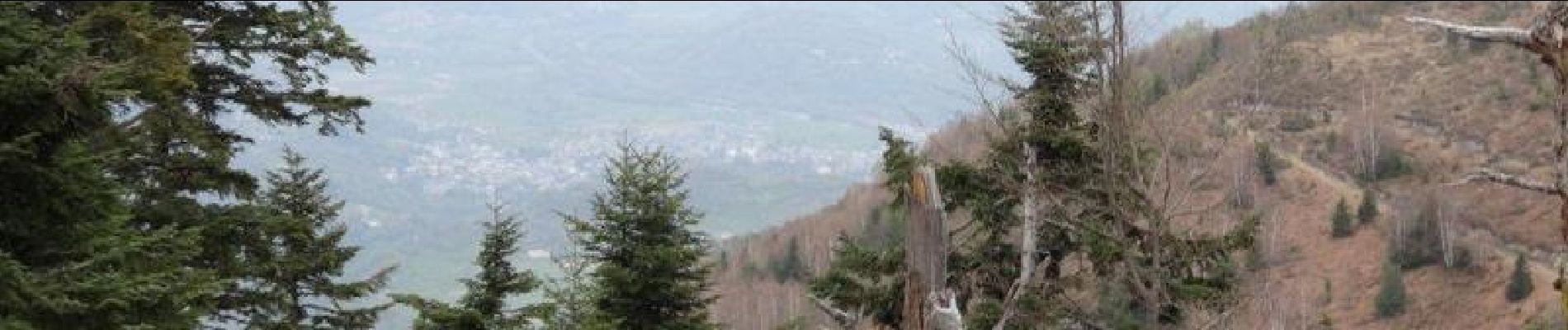
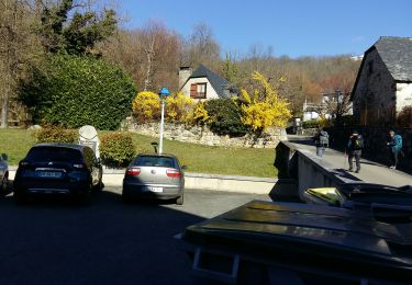
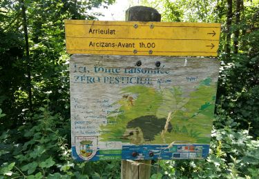
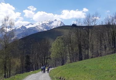
Départ des granges de Luncet, au-dessus de Sireix, à la fin de la route goudronnée. On attaque la montée dans le bois de Curalère pour enchaîner ensuite le Roc de l'Aussère, le Rocher de l'Angélus, le Turon de Bène et sa charmante cabane en bois, et pour aboutir au sommet du Pouy Droumide à 1711 m. Belles vues sur la vallée d'Argelaès et la vallée d'Estaing. Descente en passant par la cabane de Banciole.

Elevation profile

Photos

Positioning

Country:
France
Region :
Occitania
Department/Province :
Hautespyrenees
Municipality :
Arras-en-Lavedan
Location:
Unknown
Start:(UTM)
733404 ; 4761759 (30T) N.

Trails nearby

Trail Walking Arcizans-Dessus - la fontaine de Nabias - Photo
Walking
bernardbelmas

Walking

Very easy
(1)
Arcizans-Dessus, Occitania, Hautespyrenees, France
4.2 km | 6.8 km-effort
1h 40min
Yes
Trail Walking Argelès-Gazost - Le Mont de Gez en circuit - Argelès Gazost - Photo
Walking
tracegps

Walking

Medium
(1)
Argelès-Gazost, Occitania, Hautespyrenees, France
11.8 km | 20 km-effort
4h 30min
Yes
Trail Electric bike Argelès-Gazost - CABALIROS 30 JUIN 2023 - Photo
Electric bike
GUIDE
harydh

Electric bike

Medium
Argelès-Gazost, Occitania, Hautespyrenees, France
39 km | 57 km-effort
4h 47min
Yes
Trail Walking Argelès-Gazost - ARGELES La boucle de l arrieulat - Photo
Walking
GUIDE
marmotte65

Walking

Difficult
Argelès-Gazost, Occitania, Hautespyrenees, France
10.3 km | 14.6 km-effort
3h 4min
Yes
Trail Walking Gaillagos - GAILLAGOS / Couret / Couraduque en boucle reco G3 - Photo
Walking
GUIDE
marmotte65

Walking

Difficult
Gaillagos, Occitania, Hautespyrenees, France
8.4 km | 14.3 km-effort
2h 30min
Yes
Trail Walking Argelès-Gazost - ARGELES-GAZOST chateau et lac d'Arcizans depuis l'Arieulat  faitG - Photo
Walking
GUIDE
marmotte65

Walking

Easy
Argelès-Gazost, Occitania, Hautespyrenees, France
7.9 km | 11.8 km-effort
4h 56min
Yes
Trail Walking Argelès-Gazost - ARGELES Mont de Gez G3 fait - Photo
Walking
GUIDE
marmotte65

Walking

Medium
Argelès-Gazost, Occitania, Hautespyrenees, France
10.2 km | 18.3 km-effort
5h 39min
Yes
Trail Walking Gaillagos - GAILLAGOS Col de Couret Couraduque en boucle G3 du 21/04/2023
Walking
GUIDE
marmotte65

Walking

Difficult
Gaillagos, Occitania, Hautespyrenees, France
8.2 km | 14.2 km-effort
2h 46min
Yes
Trail On foot Saint-Savin - SAINT SAVIN Les 4 chapelles - Photo
On foot
GUIDE
marmotte65

On foot

Easy
Saint-Savin, Occitania, Hautespyrenees, France
7.1 km | 12.8 km-effort
2h 16min
No


Close
My subscriptions