


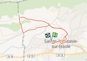
Boucle Issole

frizou83
User

Length
5 km

Max alt
303 m

Uphill gradient
66 m
Km-Effort
5.9 km

Min alt
273 m

Downhill gradient
66 m
Boucle
Yes
Creation date :
2014-12-10 00:00:00.0
Updated on :
2014-12-10 00:00:00.0
30m
Difficulty : Very easy

FREE GPS app for hiking
 SityTrail
IGN / Geographical institutes
SityTrail Plus
The world is yours!
About
Trail Running of 5 km to be discovered at Provence-Alpes-Côte d'Azur, Var, Sainte-Anastasie-sur-Issole. This trail is proposed by frizou83.
Positioning
Country:
France
Region :
Provence-Alpes-Côte d'Azur
Department/Province :
Var
Municipality :
Sainte-Anastasie-sur-Issole
Location:
Unknown
Start:(Dec)
Start:(UTM)
266722 ; 4802923 (32T) N.
Comments