Trail Mountain bike Chalmazel-Jeansagnière - Nature dans les Monts du Forez - Photo
 ramsay
ramsay

User

© OpenStreetMap contributors
Length
Length
34 km
Max alt
Max alt
1422 m
Uphill gradient
Uphill gradient
1037 m
Km-Effort
Km-Effort  
48 km
Min alt
Min alt
882 m
Downhill gradient
Downhill gradient
1032 m
Boucle
Boucle
No
Creation date :
2014-12-10 00:00:00.0
Updated on :
2014-12-10 00:00:00.0

(1 Reviews)

Mountain bike
Mountain bike
3h02
Difficulty : Difficult

Scan this QR Code to open this trail in the SityTrail application

FREE GPS app for hiking

Logo SityTrail SityTrail

IGN / Geographical institutes

Download SityTrail from the App Store Download SityTrail from Google Play

Logo SityTrail SityTrail World

The world is yours!

Download SityTrail from the App Store Download SityTrail from Google Play Download SityTrail on Huawei AppGallery

About

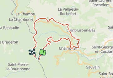
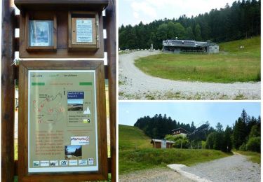
Trail Mountain bike of 34 km to be discovered at Auvergne-Rhône-Alpes, Loire, Chalmazel-Jeansagnière. This trail is proposed by ramsay.

Description

Boucle depuis le Col du Béal en passant par Chalmazel

Elevation profile

Positioning

Country:
France
Region :
Auvergne-Rhône-Alpes
Department/Province :
Loire
Municipality :
Chalmazel-Jeansagnière
Location:
Chalmazel
Start:(UTM)
561305 ; 5059394 (31T) N.

Comments

Please log in to post a review or rate the element


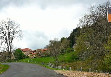
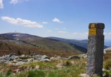
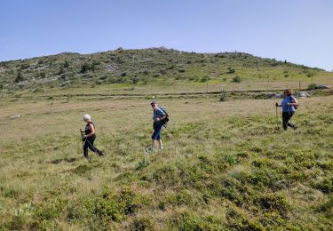
Chemins avec beaucoup de pierres, impossible à rouler. Chemins non tracés dans la bruyère. Dommage, le paysage est superbe


Trails nearby

Trail On foot Saint-Pierre-la-Bourlhonne - Peyre-Mayou - Photo
On foot
PRO

On foot

Medium
Saint-Pierre-la-Bourlhonne, Auvergne-Rhône-Alpes, Puy-de-Dôme, France
14.5 km | 23 km-effort
5h 7min
Yes
Trail Walking Job - Job_Pierre_Haute - Photo
Walking
GUIDE
jagarnier

Walking

Difficult
Job, Auvergne-Rhône-Alpes, Puy-de-Dôme, France
15.9 km | 24 km-effort
4h 45min
Yes
Trail Walking Saint-Pierre-la-Bourlhonne - St_Pierre_Peyre_Mayou - Photo
Walking
GUIDE
jagarnier

Walking

Difficult
Saint-Pierre-la-Bourlhonne, Auvergne-Rhône-Alpes, Puy-de-Dôme, France
15 km | 24 km-effort
4h 45min
Yes
Trail Walking Saint-Pierre-la-Bourlhonne - tour de pierre sur haute - Photo
Walking
antoine63480

Walking

Very easy
(1)
Saint-Pierre-la-Bourlhonne, Auvergne-Rhône-Alpes, Puy-de-Dôme, France
11.2 km | 18.6 km-effort
3h 48min
No
Trail Running Chalmazel-Jeansagnière - Le Tour de La Pierre sur Haute par les plateaux  - Photo
Running
tracegps

Running

Very difficult
Chalmazel-Jeansagnière, Auvergne-Rhône-Alpes, Loire, France
17 km | 24 km-effort
4h 0min
Yes
Trail Walking Chalmazel-Jeansagnière - Le Tour de La Pierre sur Haute par les plateaux  - Photo
Walking
tracegps

Walking

Very difficult
Chalmazel-Jeansagnière, Auvergne-Rhône-Alpes, Loire, France
17 km | 24 km-effort
6h 0min
Yes
Trail Walking Job - Col de Beal - Photo
Walking
jpdroux

Walking

Very difficult
Job, Auvergne-Rhône-Alpes, Puy-de-Dôme, France
16.2 km | 23 km-effort
6h 12min
No
Trail Walking Saint-Pierre-la-Bourlhonne - 220621-StJean.Vêtre - Col Béal - Photo
Walking
randodan

Walking

Difficult
Saint-Pierre-la-Bourlhonne, Auvergne-Rhône-Alpes, Puy-de-Dôme, France
6.7 km | 10.6 km-effort
2h 47min
Yes
Trail On foot Le Brugeron - Le Puy Gros - Photo
On foot
PRO

On foot

Medium
Le Brugeron, Auvergne-Rhône-Alpes, Puy-de-Dôme, France
15.6 km | 24 km-effort
5h 28min
Yes


Close
My subscriptions