


GTJ Sud-nord

svp59
User

Length
362 km

Max alt
1711 m

Uphill gradient
12636 m
Km-Effort
530 km

Min alt
236 m

Downhill gradient
12519 m
Boucle
No
Creation date :
2014-12-10 00:00:00.0
Updated on :
2014-12-10 00:00:00.0
103h35
Difficulty : Medium

FREE GPS app for hiking
 SityTrail
IGN / Geographical institutes
SityTrail Plus
The world is yours!
About
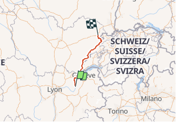
Trail Walking of 362 km to be discovered at Auvergne-Rhône-Alpes, Ain, Culoz. This trail is proposed by svp59.
Description
Intégrale GTJ Culoz-Mandeure
Points of interest

Positioning
Country:
France
Region :
Auvergne-Rhône-Alpes
Department/Province :
Ain
Municipality :
Culoz
Location:
Unknown
Start:(Dec)
Start:(UTM)
715759 ; 5080404 (31T) N.
Comments