


Von der Brücke bis SAC Cava

brunokoch1
User
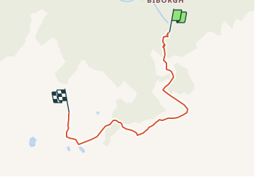

Length
5.3 km

Max alt
2096 m

Uphill gradient
854 m
Km-Effort
13.9 km

Min alt
1233 m

Downhill gradient
28 m
Boucle
No
Creation date :
2014-12-11 00:00:00.0
Updated on :
2014-12-11 00:00:00.0
--
Difficulty : Unknown

FREE GPS app for hiking
 SityTrail
IGN / Geographical institutes
SityTrail Plus
The world is yours!
About
Trail Other activity of 5.3 km to be discovered at Ticino, Distretto di Riviera, Biasca. This trail is proposed by brunokoch1.
Positioning
Country:
Switzerland
Region :
Ticino
Department/Province :
Distretto di Riviera
Municipality :
Biasca
Location:
Unknown
Start:(Dec)
Start:(UTM)
504194 ; 5135234 (32T) N.
Comments