Trail Walking Vimartin-sur-Orthe - Saint-Martin-de-Connée - La Chapelle Notre Dame du Chêne - Photo

Saint-Martin-de-Connée - La Chapelle Notre Dame du Chêne

 neitag61
neitag61

User

© OpenStreetMap contributors
Length
Length
20 km
Max alt
Max alt
266 m
Uphill gradient
Uphill gradient
393 m
Km-Effort
Km-Effort  
25 km
Min alt
Min alt
132 m
Downhill gradient
Downhill gradient
393 m
Boucle
Boucle
Yes
Creation date :
2014-12-10 00:00:00.0
Updated on :
2014-12-10 00:00:00.0

(0 Reviews)

Walking
Walking
5h23
Difficulty : Medium

Scan this QR Code to open this trail in the SityTrail application

FREE GPS app for hiking

Logo SityTrail SityTrail

IGN / Geographical institutes

Download SityTrail from the App Store Download SityTrail from Google Play

Logo SityTrail SityTrail World

The world is yours!

Download SityTrail from the App Store Download SityTrail from Google Play Download SityTrail on Huawei AppGallery

About

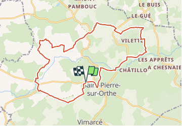
Trail Walking of 20 km to be discovered at Pays de la Loire, Mayenne, Vimartin-sur-Orthe. This trail is proposed by neitag61.

Elevation profile

Photos

Points of interest

Point of interest Vimartin-sur-Orthe - Chapelle Notre Dame du Chêne - Photo
neitag61
VIMARTIN-SUR-ORTHE 

Positioning

Country:
France
Region :
Pays de la Loire
Department/Province :
Mayenne
Municipality :
Vimartin-sur-Orthe
Location:
Unknown
Start:(UTM)
706727 ; 5343826 (30U) N.

Trails nearby

Trail On foot Vimartin-sur-Orthe - Circuit de Saint-Pierre-sur-Orthe - Photo
On foot
PRO

On foot

Medium
Vimartin-sur-Orthe, Pays de la Loire, Mayenne, France
18.8 km | 24 km-effort
5h 30min
Yes
Trail On foot Vimartin-sur-Orthe - Circuit de Saint-Martin-de-Connée - Photo
On foot
PRO

On foot

Medium
Vimartin-sur-Orthe, Pays de la Loire, Mayenne, France
16.3 km | 21 km-effort
4h 39min
Yes
Trail On foot Saint-Germain-de-Coulamer - Sentier de Bel Air (b) - Photo
On foot
PRO

On foot

Easy
Saint-Germain-de-Coulamer, Pays de la Loire, Mayenne, France
4.9 km | 6.3 km-effort
1h 25min
Yes
Trail Car Vimartin-sur-Orthe - 2022-11-19 SduC Sille le G - Photo
Car
patrick2m

Car

Vimartin-sur-Orthe, Pays de la Loire, Mayenne, France
50 km | 61 km-effort
3h 39min
No
Trail On foot Vimartin-sur-Orthe - Circuit de Vimarcé - Photo
On foot
PRO

On foot

Easy
Vimartin-sur-Orthe, Pays de la Loire, Mayenne, France
12.4 km | 15.7 km-effort
3h 33min
Yes
Trail Nordic walking Le Grez - Fr Le Grez 16-11 2019  - Photo
Nordic walking
clauderando

Nordic walking

Very easy
Le Grez, Pays de la Loire, Sarthe, France
10.8 km | 12.6 km-effort
2h 15min
Yes
Trail Equestrian Vimartin-sur-Orthe - Chevaux du Montaigu_Sille_21 juin 2015 - Photo
Equestrian
mimi53

Equestrian

Easy
Vimartin-sur-Orthe, Pays de la Loire, Mayenne, France
30 km | 37 km-effort
4h 36min
Yes
Trail Equestrian Vimartin-sur-Orthe -  Chevaux du Montaigu 8 mars 2015 - Photo
Equestrian
mimi53

Equestrian

Medium
Vimartin-sur-Orthe, Pays de la Loire, Mayenne, France
30 km | 38 km-effort
4h 40min
Yes
Trail Nordic walking Vimartin-sur-Orthe - Fr La Boissière 19-04-2024 RS 8,9 km - Photo
Nordic walking
clauderando

Nordic walking

Very easy
Vimartin-sur-Orthe, Pays de la Loire, Mayenne, France
8.9 km | 11.4 km-effort
2h 34min
Yes


Close
My subscriptions