


aircelle

Pit76
User

Length
9 km

Max alt
71 m

Uphill gradient
85 m
Km-Effort
10.4 km

Min alt
0 m

Downhill gradient
153 m
Boucle
No
Creation date :
2014-12-10 00:00:00.0
Updated on :
2014-12-10 00:00:00.0
36m
Difficulty : Easy

FREE GPS app for hiking
 SityTrail
IGN / Geographical institutes
SityTrail Plus
The world is yours!
About
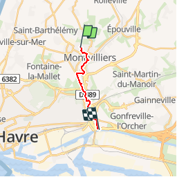
Trail Cycle of 9 km to be discovered at Normandy, Seine-Maritime, Montivilliers. This trail is proposed by Pit76.
Positioning
Country:
France
Region :
Normandy
Department/Province :
Seine-Maritime
Municipality :
Montivilliers
Location:
Unknown
Start:(Dec)
Start:(UTM)
296208 ; 5492599 (31U) N.
Comments