Trail Walking Saint-Julien-de-Coppel - 
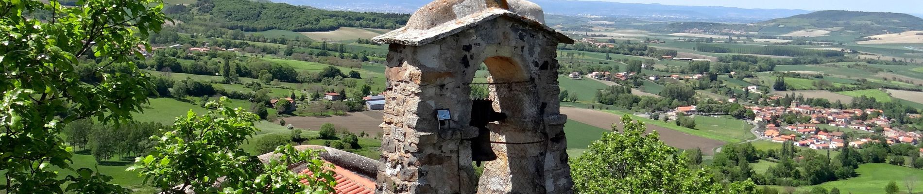
St_Julien_Dame_Roche_JG_03 - Photo
 jagarnier
jagarnier

User GUIDE

© OpenStreetMap contributors
Length
Length
14.2 km
Max alt
Max alt
663 m
Uphill gradient
Uphill gradient
420 m
Km-Effort
Km-Effort  
19.8 km
Min alt
Min alt
437 m
Downhill gradient
Downhill gradient
422 m
Boucle
Boucle
Yes
Creation date :
2018-05-13 05:52:02.037
Updated on :
2021-08-04 16:40:26.42

(0 Reviews)

Walking
Walking
4h14
Difficulty : Medium

Scan this QR Code to open this trail in the SityTrail application

FREE GPS app for hiking

Logo SityTrail SityTrail

IGN / Geographical institutes

Download SityTrail from the App Store Download SityTrail from Google Play

Logo SityTrail SityTrail Plus

The world is yours!

Download SityTrail from the App Store Download SityTrail from Google Play Download SityTrail on Huawei AppGallery

About

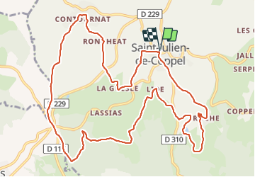
Trail Walking of 14.2 km to be discovered at Auvergne-Rhône-Alpes, Puy-de-Dôme, Saint-Julien-de-Coppel. This trail is proposed by jagarnier.

Description

De part et d'autre du col de Potey, St Julien de Coppel et Laps se trouvent à la frontière du Billomois et de la Comté. Depuis l’antiquité l'homme a laissé de nombreuses traces à découvrir de hameau en hameau. Le point incontournable de cette randonnée est la chapelle ND de Roche surplombant Billom et les monts du Livradois.

Elevation profile

Photos

Positioning

Country:
France
Region :
Auvergne-Rhône-Alpes
Department/Province :
Puy-de-Dôme
Municipality :
Saint-Julien-de-Coppel
Location:
Unknown
Start:(UTM)
524126 ; 5060185 (31T) N.


Close
My subscriptions