Trail Walking Aubusson-d'Auvergne - Courpiere_Salet - Photo
 jagarnier
jagarnier

User GUIDE

© OpenStreetMap contributors
Length
Length
11.1 km
Max alt
Max alt
464 m
Uphill gradient
Uphill gradient
289 m
Km-Effort
Km-Effort  
15 km
Min alt
Min alt
330 m
Downhill gradient
Downhill gradient
288 m
Boucle
Boucle
Yes
Creation date :
2018-05-19 06:20:14.644
Updated on :
2023-07-21 06:43:08.216

(1 Reviews)

Walking
Walking
3h15
Difficulty : Medium

Scan this QR Code to open this trail in the SityTrail application

FREE GPS app for hiking

Logo SityTrail SityTrail

IGN / Geographical institutes

Download SityTrail from the App Store Download SityTrail from Google Play

Logo SityTrail SityTrail World

The world is yours!

Download SityTrail from the App Store Download SityTrail from Google Play Download SityTrail on Huawei AppGallery

About

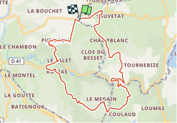
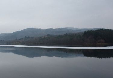
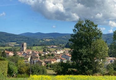
Trail Walking of 11.1 km to be discovered at Auvergne-Rhône-Alpes, Puy-de-Dôme, Aubusson-d'Auvergne. This trail is proposed by jagarnier.

Description

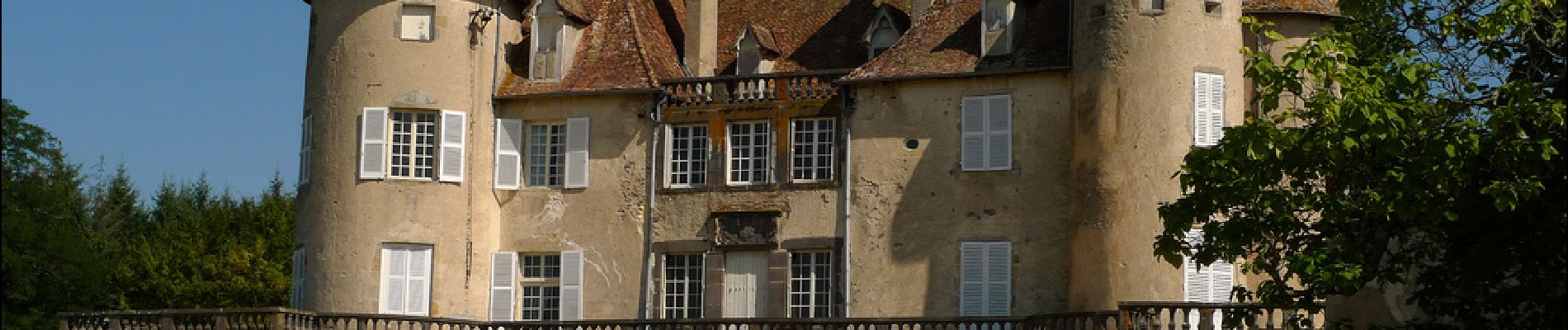
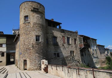
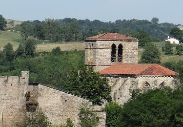
A l'écart de Courpière et des bourgs industriels égrenés le long de la Dore, les premiers contreforts du Forez permettent de découvrir de belles fermes à Pugnat et à La Souche , siège d'une ancienne seigneurie.
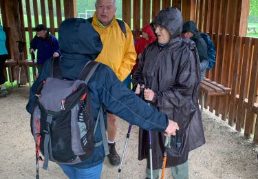
Elevation profile

Photos

Positioning

Country:
France
Region :
Auvergne-Rhône-Alpes
Department/Province :
Puy-de-Dôme
Municipality :
Aubusson-d'Auvergne
Location:
Unknown
Start:(UTM)
544653 ; 5067016 (31T) N.

Comments

Please log in to post a review or rate the element


Trails nearby

Trail Walking Courpière - Courpiere_Courtesserre - Photo
Walking
GUIDE
jagarnier

Walking

Medium
(1)
Courpière, Auvergne-Rhône-Alpes, Puy-de-Dôme, France
9.7 km | 12.8 km-effort
2h 45min
Yes
Trail Walking Aubusson-d'Auvergne - Aubusson_Lac - Photo
Walking
GUIDE
jagarnier

Walking

Easy
(1)
Aubusson-d'Auvergne, Auvergne-Rhône-Alpes, Puy-de-Dôme, France
11.8 km | 14.6 km-effort
3h 15min
Yes
Trail Walking Courpière - Les Taillades près Courpière - Photo
Walking
tracegps

Walking

Difficult
(1)
Courpière, Auvergne-Rhône-Alpes, Puy-de-Dôme, France
19.9 km | 27 km-effort
5h 0min
Yes
Trail On foot Courpière - Les collines de Courtesserre - Photo
On foot
PRO

On foot

Easy
Courpière, Auvergne-Rhône-Alpes, Puy-de-Dôme, France
9.7 km | 12.8 km-effort
2h 54min
Yes
Trail On foot Vollore-Ville - Le Grun de Chignore - Photo
On foot
PRO

On foot

Medium
Vollore-Ville, Auvergne-Rhône-Alpes, Puy-de-Dôme, France
15.1 km | 24 km-effort
5h 27min
No
Trail Walking Sauviat - Sauviat_Plateau - Photo
Walking
GUIDE
jagarnier

Walking

Medium
Sauviat, Auvergne-Rhône-Alpes, Puy-de-Dôme, France
13.4 km | 17.3 km-effort
4h 0min
Yes
Trail Walking Aubusson-d'Auvergne - Les quatre vents Aubusson 1er jour - Photo
Walking
jpdroux

Walking

Medium
Aubusson-d'Auvergne, Auvergne-Rhône-Alpes, Puy-de-Dôme, France
18 km | 23 km-effort
6h 38min
Yes
Trail On foot Augerolles - Lac et sous Bois - Photo
On foot
PRO

On foot

Easy
Augerolles, Auvergne-Rhône-Alpes, Puy-de-Dôme, France
5.2 km | 6.9 km-effort
1h 34min
Yes
Trail Walking Augerolles - Augerolles 09/2021 - Photo
Walking
boulinevelyne

Walking

Easy
Augerolles, Auvergne-Rhône-Alpes, Puy-de-Dôme, France
15.3 km | 21 km-effort
3h 51min
Yes


Close
My subscriptions