


De Mandeure à Landresse et retour.

tiene
User
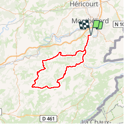

Length
97 km

Max alt
739 m

Uphill gradient
1420 m
Km-Effort
116 km

Min alt
331 m

Downhill gradient
1420 m
Boucle
Yes
Creation date :
2018-06-19 14:47:21.975
Updated on :
2019-07-24 13:58:38.429
6h45
Difficulty : Very difficult

FREE GPS app for hiking
 SityTrail
IGN / Geographical institutes
SityTrail Plus
The world is yours!
About
Trail Road bike of 97 km to be discovered at Bourgogne-Franche-Comté, Doubs, Mandeure. This trail is proposed by tiene.
Positioning
Country:
France
Region :
Bourgogne-Franche-Comté
Department/Province :
Doubs
Municipality :
Mandeure
Location:
Unknown
Start:(Dec)
Start:(UTM)
334445 ; 5257686 (32T) N.
Comments