Chambon_Vallee_Chaudefour_2

jagarnier
User GUIDE
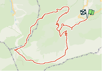

Length
15 km

Max alt
1831 m

Uphill gradient
810 m
Km-Effort
26 km

Min alt
1137 m

Downhill gradient
810 m
Boucle
Yes
Creation date :
2018-06-21 06:41:07.643
Updated on :
2024-04-03 09:15:46.827
4h30
Difficulty : Difficult

FREE GPS app for hiking
 SityTrail
IGN / Geographical institutes
SityTrail Plus
The world is yours!
About
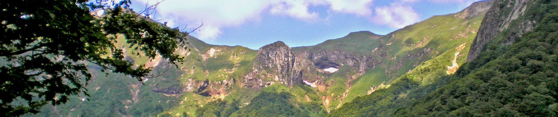
Trail Walking of 15 km to be discovered at Auvergne-Rhône-Alpes, Puy-de-Dôme, Chambon-sur-Lac. This trail is proposed by jagarnier.
Photos

Positioning
Country:
France
Region :
Auvergne-Rhône-Alpes
Department/Province :
Puy-de-Dôme
Municipality :
Chambon-sur-Lac
Location:
Unknown
Start:(Dec)
Start:(UTM)
489230 ; 5043017 (31T) N.
Comments