


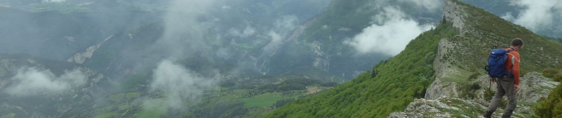
F26310 Charens Tarsimoure R2000

ageo
User
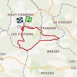

Length
13.7 km

Max alt
1537 m

Uphill gradient
786 m
Km-Effort
24 km

Min alt
840 m

Downhill gradient
779 m
Boucle
Yes
Creation date :
2018-06-30 08:25:37.481
Updated on :
2018-07-06 20:36:00.319
4h53
Difficulty : Difficult

FREE GPS app for hiking
 SityTrail
IGN / Geographical institutes
SityTrail Plus
The world is yours!
About
Trail Walking of 13.7 km to be discovered at Auvergne-Rhône-Alpes, Drôme, Charens. This trail is proposed by ageo.
Description
File with points/tracks from Locus Map/3.30.4
Photos

Positioning
Country:
France
Region :
Auvergne-Rhône-Alpes
Department/Province :
Drôme
Municipality :
Charens
Location:
Unknown
Start:(Dec)
Start:(UTM)
699389 ; 4934780 (31T) N.
Comments