Trail Walking Rasteau - 2018-06-28 Rando Rasteau - Photo
 jhack159
jhack159

User

© OpenStreetMap contributors
Length
Length
14.9 km
Max alt
Max alt
366 m
Uphill gradient
Uphill gradient
376 m
Km-Effort
Km-Effort  
19.9 km
Min alt
Min alt
185 m
Downhill gradient
Downhill gradient
371 m
Boucle
Boucle
Yes
Creation date :
2018-07-12 09:27:15.199
Updated on :
2018-07-12 10:26:53.663

(1 Reviews)

Walking
Walking
4h13
Difficulty : Difficult

Scan this QR Code to open this trail in the SityTrail application

FREE GPS app for hiking

Logo SityTrail SityTrail

IGN / Geographical institutes

Download SityTrail from the App Store Download SityTrail from Google Play

Logo SityTrail SityTrail World

The world is yours!

Download SityTrail from the App Store Download SityTrail from Google Play Download SityTrail on Huawei AppGallery

About

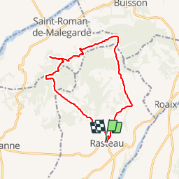
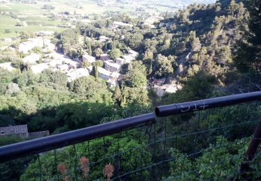
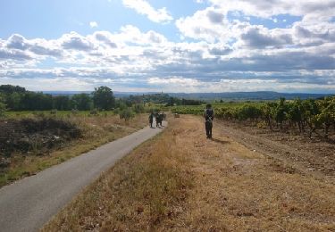
Trail Walking of 14.9 km to be discovered at Provence-Alpes-Côte d'Azur, Vaucluse, Rasteau. This trail is proposed by jhack159.

Description

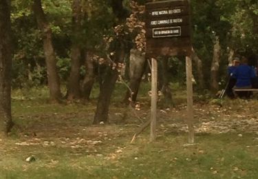
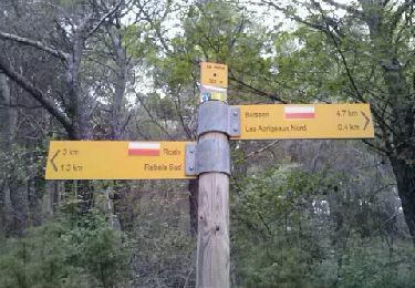
Suivant la rando 13 du topoguide "Le Haut Vaucluse et les Dantelles de Montmirail...à Pied.
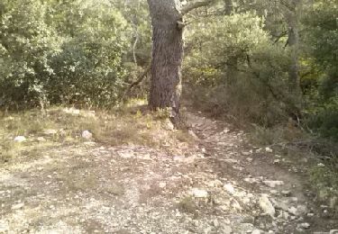
Petit soucis au point 8 du circuit, je n'ai pas trouvé l'échalier afin d'enjamber la cloture electrique.
J'ai donc contourner le champs par les sentiers les plus proches et me ramenant vers le GR4 en direction de Rasteau

Elevation profile

Positioning

Country:
France
Region :
Provence-Alpes-Côte d'Azur
Department/Province :
Vaucluse
Municipality :
Rasteau
Location:
Unknown
Start:(UTM)
658526 ; 4899359 (31T) N.

Comments

Please log in to post a review or rate the element


Trails nearby

Trail Walking Séguret - 170917 EnCours - Photo
Walking
MarcheEtReve

Walking

Very easy
(1)
Séguret, Provence-Alpes-Côte d'Azur, Vaucluse, France
6.3 km | 9.8 km-effort
2h 8min
Yes
Trail Walking Cairanne - Cairanne - Photo
Walking
legios84

Walking

Medium
(1)
Cairanne, Provence-Alpes-Côte d'Azur, Vaucluse, France
22 km | 28 km-effort
4h 32min
Yes
Trail Walking Buisson - foret buisson - Photo
Walking
lunikodacious

Walking

Easy
(1)
Buisson, Provence-Alpes-Côte d'Azur, Vaucluse, France
5.4 km | 7 km-effort
50min
Yes
Trail Walking Roaix - Alentour de Roaix - Photo
Walking
atuttabirra

Walking

Very easy
(2)
Roaix, Provence-Alpes-Côte d'Azur, Vaucluse, France
10.1 km | 13.5 km-effort
2h 42min
Yes
Trail Walking Sablet - 2024-01-12_13h24m19_sablet-prebayon-seguret-reco-validee - Photo
Walking
Maryma

Walking

Medium
(1)
Sablet, Provence-Alpes-Côte d'Azur, Vaucluse, France
19 km | 27 km-effort
6h 9min
Yes
Trail Walking Sablet - Les crêtes de saint Amant  - Photo
Walking
jlouisvideo

Walking

Medium
Sablet, Provence-Alpes-Côte d'Azur, Vaucluse, France
13.8 km | 21 km-effort
6h 43min
Yes
Trail Walking Séguret - 2019-06-25 Seguret - Photo
Walking
jhack159

Walking

(1)
Séguret, Provence-Alpes-Côte d'Azur, Vaucluse, France
7.4 km | 11.4 km-effort
Unknown
Yes
Trail Walking Cairanne - 170919 EnCours - Photo
Walking
MarcheEtReve

Walking

Very easy
Cairanne, Provence-Alpes-Côte d'Azur, Vaucluse, France
7.9 km | 11 km-effort
2h 19min
Yes
Trail Walking Séguret - seguret fontaine fée - Photo
Walking
lunikodacious

Walking

Very easy
Séguret, Provence-Alpes-Côte d'Azur, Vaucluse, France
9.5 km | 12.8 km-effort
1h 42min
Yes


Close
My subscriptions