


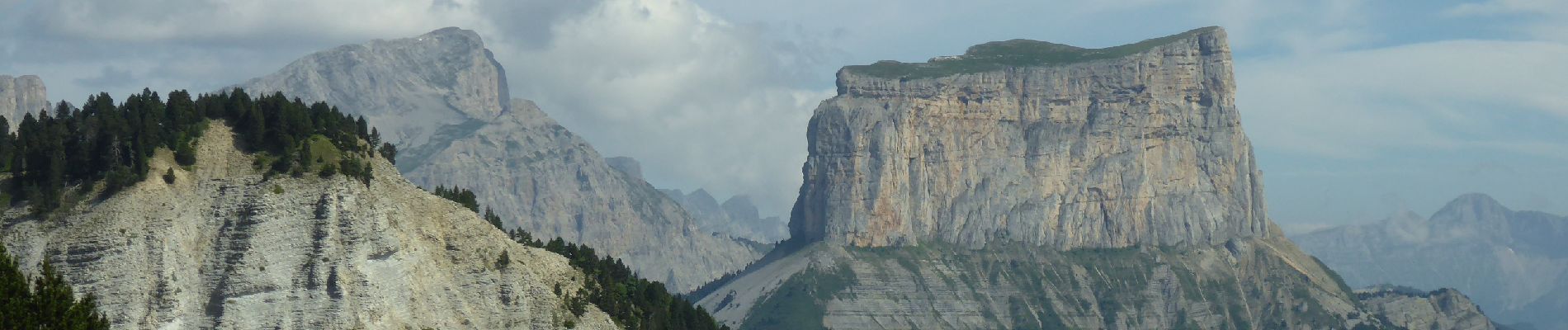
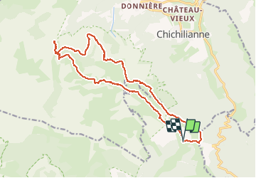
F26410 Combau Tête Chevalière

ageo
User

Length
19.7 km

Max alt
1946 m

Uphill gradient
909 m
Km-Effort
32 km

Min alt
1461 m

Downhill gradient
907 m
Boucle
Yes
Creation date :
2018-07-13 08:28:37.962
Updated on :
2018-07-13 08:48:06.238
6h33
Difficulty : Medium

FREE GPS app for hiking
 SityTrail
IGN / Geographical institutes
SityTrail Plus
The world is yours!
About
Trail Walking of 19.7 km to be discovered at Auvergne-Rhône-Alpes, Drôme, Châtillon-en-Diois. This trail is proposed by ageo.
Description
File with points/tracks from Locus Map/3.31.3
Photos


Positioning
Country:
France
Region :
Auvergne-Rhône-Alpes
Department/Province :
Drôme
Municipality :
Châtillon-en-Diois
Location:
Treschenu-Creyers
Start:(Dec)
Start:(UTM)
703622 ; 4961138 (31T) N.
Comments