Trail Walking Saint-Gervais-les-Bains - Chalet du Truc - Miage - Photo
© OpenStreetMap contributors
Length
Length
10.3 km
Max alt
Max alt
1797 m
Uphill gradient
Uphill gradient
699 m
Km-Effort
Km-Effort  
19.6 km
Min alt
Min alt
1130 m
Downhill gradient
Downhill gradient
697 m
Boucle
Boucle
Yes
Creation date :
2018-07-13 15:02:19.105
Updated on :
2020-09-27 12:33:15.314

(0 Reviews)

Walking
Walking
3h56
Difficulty : Difficult

Scan this QR Code to open this trail in the SityTrail application

FREE GPS app for hiking

Logo SityTrail SityTrail

IGN / Geographical institutes

Download SityTrail from the App Store Download SityTrail from Google Play

Logo SityTrail SityTrail Plus

The world is yours!

Download SityTrail from the App Store Download SityTrail from Google Play Download SityTrail on Huawei AppGallery

About

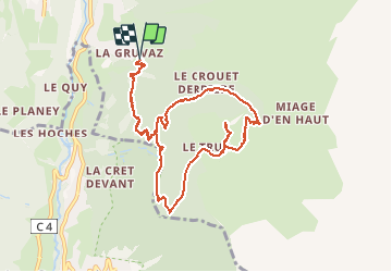
Trail Walking of 10.3 km to be discovered at Auvergne-Rhône-Alpes, Upper Savoy, Saint-Gervais-les-Bains. This trail is proposed by Philindy26.

Description

Départ du parking de Gruvaz, Saint-Gervais-les-Bains (1090 m) - ( Géolocalisation (Google Maps) : https://goo.gl/maps/cswMVyNXeBT3yw6u8 ).
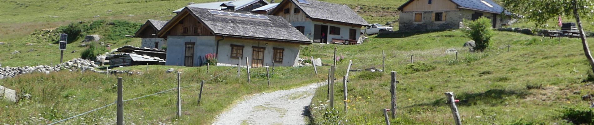
Montée aux chalets du Truc, puis aller-retour sur le Mont-Truc (1811 m).
Retour par les chalets de Miage (1550 m).

Elevation profile

Photos

Positioning

Country:
France
Region :
Auvergne-Rhône-Alpes
Department/Province :
Upper Savoy
Municipality :
Saint-Gervais-les-Bains
Location:
Unknown
Start:(UTM)
324443 ; 5079440 (32T) N.


Close
My subscriptions