


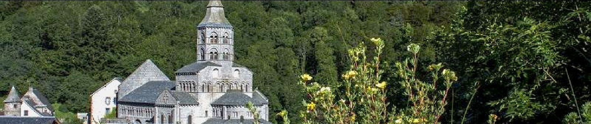
Orcival_Notre_Dame_Fers

jagarnier
User GUIDE
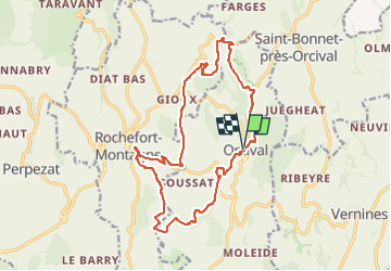

Length
17.2 km

Max alt
1085 m

Uphill gradient
523 m
Km-Effort
24 km

Min alt
782 m

Downhill gradient
522 m
Boucle
Yes
Creation date :
2018-07-16 12:07:53.827
Updated on :
2023-05-10 04:43:42.717
5h15
Difficulty : Difficult

FREE GPS app for hiking
 SityTrail
IGN / Geographical institutes
SityTrail Plus
The world is yours!
About
Trail Walking of 17.2 km to be discovered at Auvergne-Rhône-Alpes, Puy-de-Dôme, Orcival. This trail is proposed by jagarnier.
Photos

Positioning
Country:
France
Region :
Auvergne-Rhône-Alpes
Department/Province :
Puy-de-Dôme
Municipality :
Orcival
Location:
Unknown
Start:(Dec)
Start:(UTM)
487668 ; 5058873 (31T) N.
Comments