


20180703111337-aJCEd

holtzv
User GUIDE

Length
22 km

Max alt
1904 m

Uphill gradient
1041 m
Km-Effort
37 km

Min alt
1037 m

Downhill gradient
1206 m
Boucle
No
Creation date :
2018-07-16 20:00:28.327
Updated on :
2018-07-25 08:56:55.236
7h27
Difficulty : Very difficult

FREE GPS app for hiking
 SityTrail
IGN / Geographical institutes
SityTrail Plus
The world is yours!
About
Trail Walking of 22 km to be discovered at Auvergne-Rhône-Alpes, Isère, Gresse-en-Vercors. This trail is proposed by holtzv.
Description
De Gresse à Richardière_23km_970mPos_1130mNeg
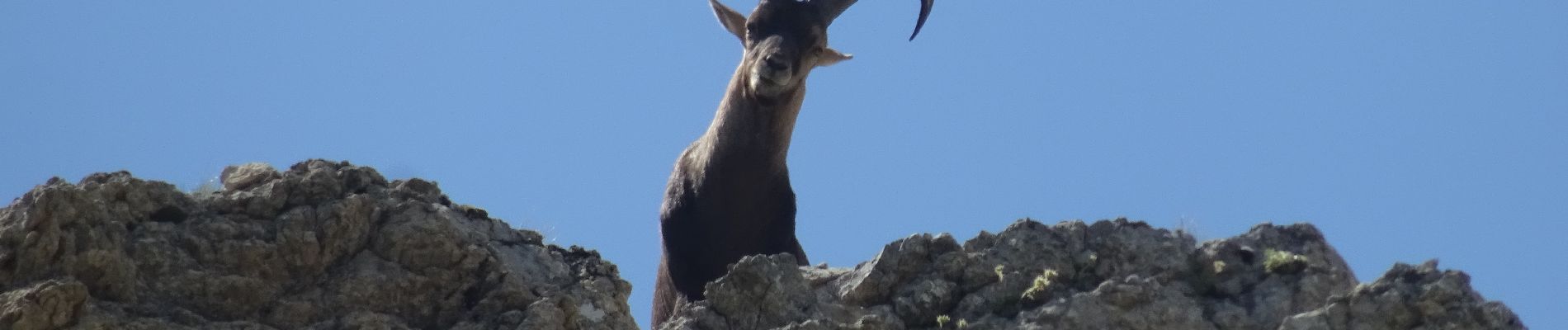
Photos

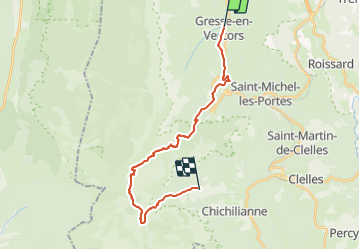
Positioning
Country:
France
Region :
Auvergne-Rhône-Alpes
Department/Province :
Isère
Municipality :
Gresse-en-Vercors
Location:
Unknown
Start:(Dec)
Start:(UTM)
702635 ; 4975240 (31T) N.
Comments