


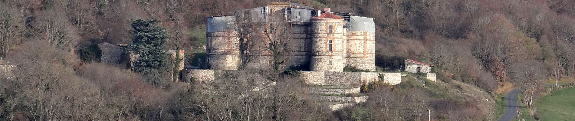
Pignols_Chaux_Montgros

jagarnier
User GUIDE
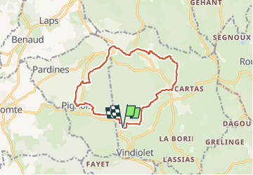

Length
13.1 km

Max alt
705 m

Uphill gradient
406 m
Km-Effort
18.5 km

Min alt
565 m

Downhill gradient
406 m
Boucle
Yes
Creation date :
2018-07-21 16:56:11.715
Updated on :
2024-02-08 09:04:33.681
4h00
Difficulty : Medium

FREE GPS app for hiking
 SityTrail
IGN / Geographical institutes
SityTrail Plus
The world is yours!
About
Trail Walking of 13.1 km to be discovered at Auvergne-Rhône-Alpes, Puy-de-Dôme, Sallèdes. This trail is proposed by jagarnier.
Photos

Positioning
Country:
France
Region :
Auvergne-Rhône-Alpes
Department/Province :
Puy-de-Dôme
Municipality :
Sallèdes
Location:
Unknown
Start:(Dec)
Start:(UTM)
523831 ; 5053792 (31T) N.
Comments