


12732 t14500-MNT

jagarnier
User GUIDE
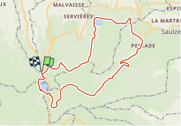

Length
21 km

Max alt
1486 m

Uphill gradient
654 m
Km-Effort
30 km

Min alt
1116 m

Downhill gradient
654 m
Boucle
Yes
Creation date :
2018-07-22 16:48:22.221
Updated on :
2025-03-12 17:07:19.454
6h30
Difficulty : Difficult

FREE GPS app for hiking
 SityTrail
IGN / Geographical institutes
SityTrail Plus
The world is yours!
About
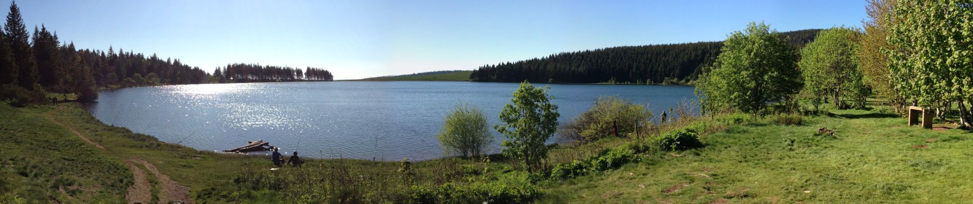
Trail Walking of 21 km to be discovered at Auvergne-Rhône-Alpes, Puy-de-Dôme, Orcival. This trail is proposed by jagarnier.
Photos

Positioning
Country:
France
Region :
Auvergne-Rhône-Alpes
Department/Province :
Puy-de-Dôme
Municipality :
Orcival
Location:
Unknown
Start:(Dec)
Start:(UTM)
485994 ; 5052034 (31T) N.
Comments