Col de Rouannette 22/07/18
R@ph
User GUIDE
Length
9.3 km
Max alt
2391 m
Uphill gradient
802 m
Km-Effort
20 km
Min alt
1591 m
Downhill gradient
805 m
Boucle
Yes
Creation date :
2018-07-22 17:22:12.408
Updated on :
2018-07-22 17:33:08.567
3h56
Difficulty : Medium
FREE GPS app for hiking
About
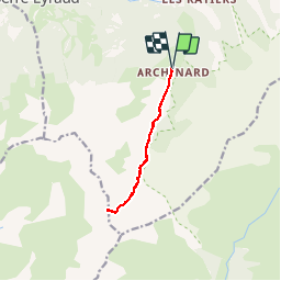
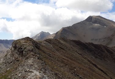
Trail Walking of 9.3 km to be discovered at Provence-Alpes-Côte d'Azur, Hautes-Alpes, Orcières. This trail is proposed by R@ph.
Description
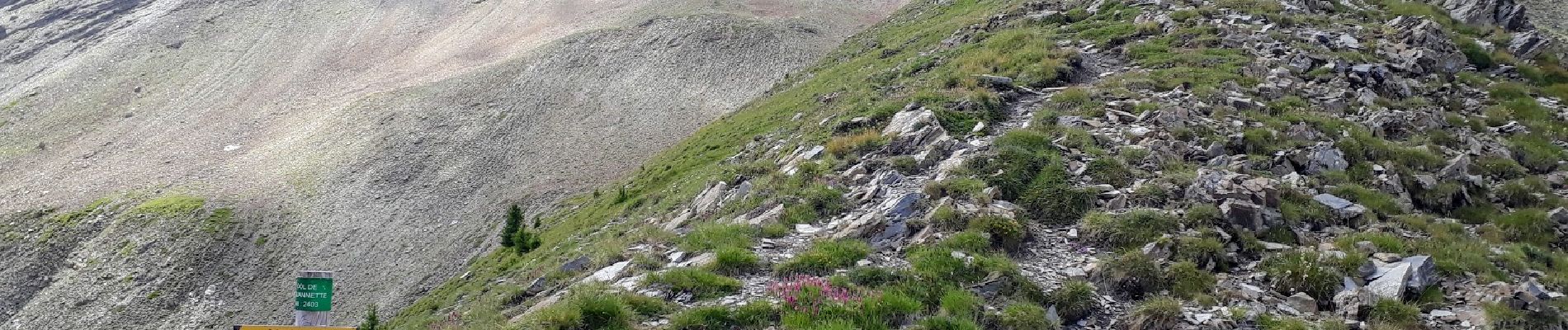
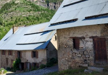
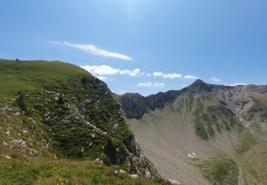
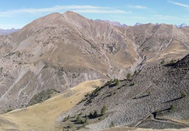
Au départ d'Archinard la montée jusqu'au col de Rouannette. Aucune difficulté pour cette randonnée, le sentier est bien marqué après la cabane de Rouannette, même s'il n'est pas mentionné sur les cartes.
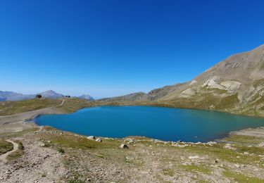
En cette fin juillet encore quelques névés vers 2300m.
Positioning
Country:
France
Region :
Provence-Alpes-Côte d'Azur
Department/Province :
Hautes-Alpes
Municipality :
Orcières
Location:
Unknown
Start:(Dec)
Start:(UTM)
287394 ; 4949043 (32T) N.
Comments
Trails nearby
Le Forest des marches
Walking
Easy
(2)
Orcières,
Provence-Alpes-Côte d'Azur,
Hautes-Alpes,
France
6.3 km | 9.9 km-effort
1h 42min
Yes
R45 Marmottes a Prapic
Walking
Medium
(2)
Orcières,
Provence-Alpes-Côte d'Azur,
Hautes-Alpes,
France
9 km | 14 km-effort
2h 57min
Yes
Orcieres (Hautes Alpes)
Walking
Very difficult
(1)
Orcières,
Provence-Alpes-Côte d'Azur,
Hautes-Alpes,
France
12 km | 19.4 km-effort
4h 24min
Yes
col de la coupa et tour de la rouanne
Walking
Difficult
(1)
Ancelle,
Provence-Alpes-Côte d'Azur,
Hautes-Alpes,
France
16.2 km | 28 km-effort
4h 56min
Yes
Roc Diolon par le col de Fressinieres 11/08/23
Walking
Very difficult
Orcières,
Provence-Alpes-Côte d'Azur,
Hautes-Alpes,
France
16.3 km | 32 km-effort
7h 21min
Yes
Le Piolt par la Pourrachiere 21/07/23
Walking
Very difficult
Ancelle,
Provence-Alpes-Côte d'Azur,
Hautes-Alpes,
France
13.7 km | 25 km-effort
5h 41min
Yes
Le Piolit par Rouanne Haute 27/09/19
Walking
Very difficult
Ancelle,
Provence-Alpes-Côte d'Azur,
Hautes-Alpes,
France
14.2 km | 26 km-effort
5h 15min
Yes
Col des Tourettes - Croix Lorraine 08/09/18
Walking
Difficult
Orcières,
Provence-Alpes-Côte d'Azur,
Hautes-Alpes,
France
21 km | 37 km-effort
5h 30min
Yes
Prapic Basset Cabane de la Barre
Walking
Medium
(1)
Orcières,
Provence-Alpes-Côte d'Azur,
Hautes-Alpes,
France
17.6 km | 30 km-effort
6h 10min
Yes