


le Mont Baret

ocepee
User
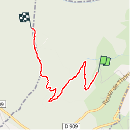

Length
2.9 km
Boucle
No
Creation date :
2018-07-27 17:21:16.907
Updated on :
2018-07-27 19:29:28.893
1h09
Difficulty : Very difficult

FREE GPS app for hiking
 SityTrail
IGN / Geographical institutes
SityTrail Plus
The world is yours!
About
Trail Walking of 2.9 km to be discovered at Auvergne-Rhône-Alpes, Upper Savoy, Menthon-Saint-Bernard. This trail is proposed by ocepee.
Description
Rando grimpette ! Ascenssion du Mont qui vaut le détour au vu du magnifique point de vue sur le lac d'annecy à la clé ! Plus qu'à redescendre !
Positioning
Country:
France
Region :
Auvergne-Rhône-Alpes
Department/Province :
Upper Savoy
Municipality :
Menthon-Saint-Bernard
Location:
Unknown
Start:(Dec)
Start:(UTM)
283206 ; 5083752 (32T) N.
Comments