


Enval_Gorges

jagarnier
User GUIDE
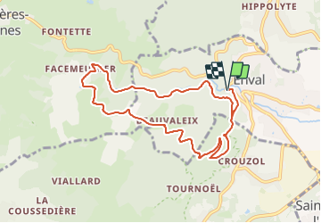

Length
9.1 km

Max alt
712 m

Uphill gradient
309 m
Km-Effort
13.2 km

Min alt
448 m

Downhill gradient
309 m
Boucle
Yes
Creation date :
2018-08-26 12:37:02.449
Updated on :
2025-06-16 15:12:13.277
3h00
Difficulty : Medium

FREE GPS app for hiking
 SityTrail
IGN / Geographical institutes
SityTrail Plus
The world is yours!
About
Trail Walking of 9.1 km to be discovered at Auvergne-Rhône-Alpes, Puy-de-Dôme, Enval. This trail is proposed by jagarnier.
Description
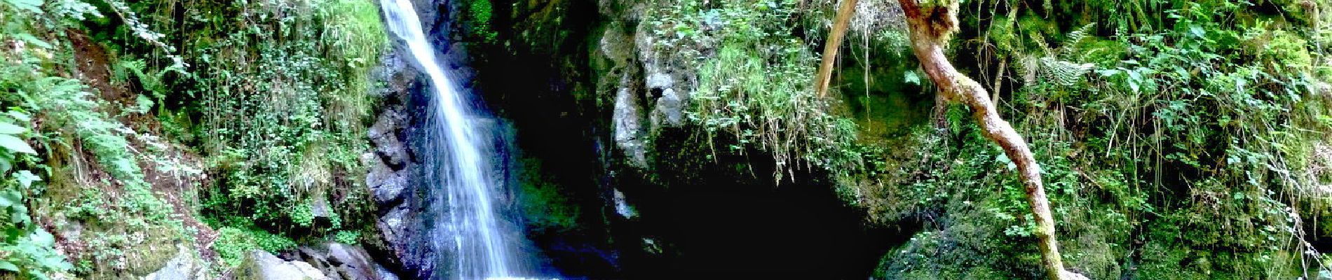
Cette randonnée dans les gorges d’Enval vous offrira le simple plaisir de marcher dans un lieu préservé, à l’abri des regards et des pollutions, à la découverte de très jolies gorges et cascades.
Photos

Positioning
Country:
France
Region :
Auvergne-Rhône-Alpes
Department/Province :
Puy-de-Dôme
Municipality :
Enval
Location:
Unknown
Start:(Dec)
Start:(UTM)
503587 ; 5082767 (31T) N.
Comments
