


ARZENS Les BRUGUES

jl_chocho
User
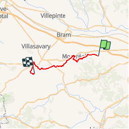

Length
24 km

Max alt
377 m

Uphill gradient
561 m
Km-Effort
31 km

Min alt
174 m

Downhill gradient
412 m
Boucle
No
Creation date :
2015-04-11 00:00:00.0
Updated on :
2015-04-11 00:00:00.0
6h40
Difficulty : Medium

FREE GPS app for hiking
 SityTrail
IGN / Geographical institutes
SityTrail Plus
The world is yours!
About
Trail Walking of 24 km to be discovered at Occitania, Aude, Arzens. This trail is proposed by jl_chocho.
Description
Étape 2 : Arzens Les Brugues (Camping)
Positioning
Country:
France
Region :
Occitania
Department/Province :
Aude
Municipality :
Arzens
Location:
Unknown
Start:(Dec)
Start:(UTM)
435790 ; 4783331 (31T) N.
Comments