


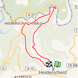
Autopedestres : Heiderscheid

Visit Luxembourg
Randonnées de Visit Luxembourg. GUIDE+

Length
7.9 km

Max alt
517 m

Uphill gradient
310 m
Km-Effort
12 km

Min alt
259 m

Downhill gradient
310 m
Boucle
Yes
Creation date :
2014-12-10 00:00:00.0
Updated on :
2014-12-10 00:00:00.0
--
Difficulty : Unknown

FREE GPS app for hiking
 SityTrail
IGN / Geographical institutes
SityTrail Plus
The world is yours!
About
Trail Walking of 7.9 km to be discovered at Unknown, Canton Wiltz, Esch-sur-Sûre. This trail is proposed by Visit Luxembourg.


Positioning
Country:
Luxembourg
Region :
Unknown
Department/Province :
Canton Wiltz
Municipality :
Esch-sur-Sûre
Location:
Unknown
Start:(Dec)
Start:(UTM)
713888 ; 5530356 (31U) N.
Comments
Schöne Strecke aber schwierig zum Schluss