


archiane

vertygo
User
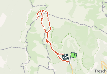

Length
19 km

Max alt
1763 m

Uphill gradient
1332 m
Km-Effort
37 km

Min alt
755 m

Downhill gradient
1346 m
Boucle
Yes
Creation date :
2018-09-04 17:53:34.272
Updated on :
2018-09-04 18:07:06.104
7h20
Difficulty : Very difficult

FREE GPS app for hiking
 SityTrail
IGN / Geographical institutes
SityTrail Plus
The world is yours!
About
Trail Walking of 19 km to be discovered at Auvergne-Rhône-Alpes, Drôme, Châtillon-en-Diois. This trail is proposed by vertygo.
Description
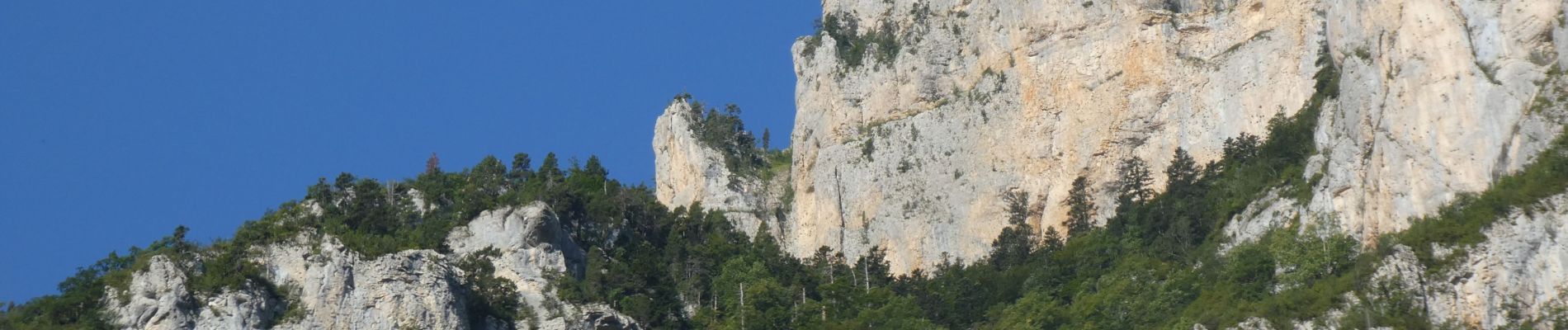
Randonnée longue avec de fortes pentes par endroits ; Vu une dizaine de mouflons et un chamois sur le bas de l'Aubaise
Photos


Positioning
Country:
France
Region :
Auvergne-Rhône-Alpes
Department/Province :
Drôme
Municipality :
Châtillon-en-Diois
Location:
Treschenu-Creyers
Start:(Dec)
Start:(UTM)
698462 ; 4957824 (31T) N.
Comments