


Autopedestres : Roder

Visit Luxembourg
Randonnées de Visit Luxembourg. GUIDE+
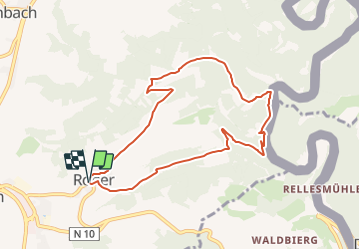

Length
7.9 km

Max alt
482 m

Uphill gradient
288 m
Km-Effort
11.8 km

Min alt
287 m

Downhill gradient
290 m
Boucle
Yes
Creation date :
2014-12-10 00:00:00.0
Updated on :
2014-12-10 00:00:00.0
--
Difficulty : Unknown

FREE GPS app for hiking
 SityTrail
IGN / Geographical institutes
SityTrail Plus
The world is yours!
About
Trail Walking of 7.9 km to be discovered at Unknown, Canton Clervaux, Clervaux. This trail is proposed by Visit Luxembourg.


Positioning
Country:
Luxembourg
Region :
Unknown
Department/Province :
Canton Clervaux
Municipality :
Clervaux
Location:
Unknown
Start:(Dec)
Start:(UTM)
291142 ; 5548845 (32U) N.
Comments
Superbe parcours boisé. Pratiquement identique au sentier local CL 4.