


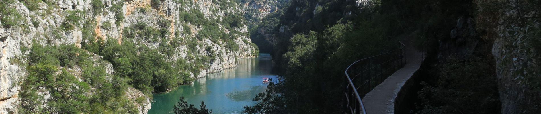
Basses gorges et chapelle Ste Maxime

Gouze13
User
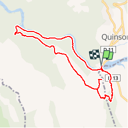

Length
9.9 km

Max alt
548 m

Uphill gradient
301 m
Km-Effort
13.9 km

Min alt
365 m

Downhill gradient
300 m
Boucle
Yes
Creation date :
2018-09-19 19:56:58.102
Updated on :
2018-09-19 19:59:48.734
2h55
Difficulty : Medium

FREE GPS app for hiking
 SityTrail
IGN / Geographical institutes
SityTrail Plus
The world is yours!
About
Trail Walking of 9.9 km to be discovered at Provence-Alpes-Côte d'Azur, Alpes-de-Haute-Provence, Quinson. This trail is proposed by Gouze13.
Photos

Positioning
Country:
France
Region :
Provence-Alpes-Côte d'Azur
Department/Province :
Alpes-de-Haute-Provence
Municipality :
Quinson
Location:
Unknown
Start:(Dec)
Start:(UTM)
261041 ; 4842229 (32T) N.
Comments