Trail Walking Le Dévoluy - 
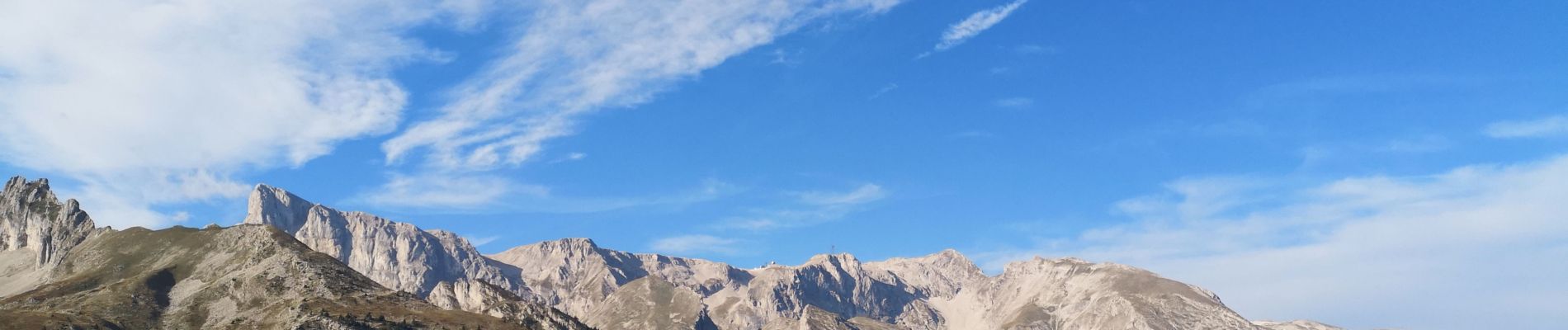
Sommet de Raz de Bec. 21/09/18 - Photo
© OpenStreetMap contributors
Length
Length
11.9 km
Max alt
Max alt
2403 m
Uphill gradient
Uphill gradient
827 m
Km-Effort
Km-Effort  
23 km
Min alt
Min alt
1615 m
Downhill gradient
Downhill gradient
828 m
Boucle
Boucle
Yes
Creation date :
2018-09-21 07:34:38.911
Updated on :
2019-04-22 15:02:09.378

(0 Reviews)

Walking
Walking
5h25
Difficulty : Difficult

Scan this QR Code to open this trail in the SityTrail application

FREE GPS app for hiking

Logo SityTrail SityTrail

IGN / Geographical institutes

Download SityTrail from the App Store Download SityTrail from Google Play

Logo SityTrail SityTrail Plus

The world is yours!

Download SityTrail from the App Store Download SityTrail from Google Play Download SityTrail on Huawei AppGallery

About

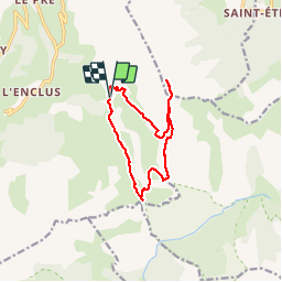
Trail Walking of 11.9 km to be discovered at Provence-Alpes-Côte d'Azur, Hautes-Alpes, Le Dévoluy. This trail is proposed by Dervalmarc.

Description

longue randonnée;difficile en raison de passages effilé en crête;prudence dans la descente du couloir du ravin de Loupon; chutes de pierres.
Nombreux Chamois dans les couloirs.

Elevation profile

Photos

25 photos in total. Please click on a photo to see them all in the gallery.

Positioning

Country:
France
Region :
Provence-Alpes-Côte d'Azur
Department/Province :
Hautes-Alpes
Municipality :
Le Dévoluy
Location:
Saint-Étienne-en-Dévoluy
Start:(UTM)
735522 ; 4949969 (31T) N.


Close
My subscriptions