


sortie vtt du 06102018 Haut de la Coye

fabwin
User GUIDE

Length
49 km

Max alt
311 m

Uphill gradient
412 m
Km-Effort
54 km

Min alt
218 m

Downhill gradient
410 m
Boucle
Yes
Creation date :
2018-10-06 12:00:39.712
Updated on :
2018-10-06 16:19:15.678
3h02
Difficulty : Medium

FREE GPS app for hiking
 SityTrail
IGN / Geographical institutes
SityTrail Plus
The world is yours!
About
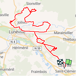
Trail Mountain bike of 49 km to be discovered at Grand Est, Meurthe-et-Moselle, Saint-Clément. This trail is proposed by fabwin.
Description
Belle sortie avec Séb, David, Luca & Maxime.
Du roulant, du chemin, du champs ( spécialement pour David), un sentier romain.
Photos


Positioning
Country:
France
Region :
Grand Est
Department/Province :
Meurthe-et-Moselle
Municipality :
Saint-Clément
Location:
Unknown
Start:(Dec)
Start:(UTM)
323005 ; 5378517 (32U) N.
Comments