


Mareugheol_Vodable_Colamine

jagarnier
User GUIDE
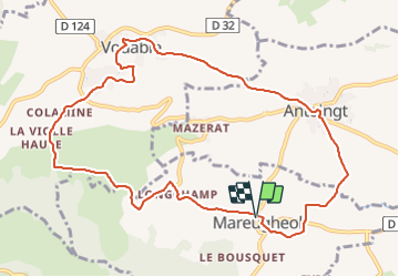

Length
11.1 km

Max alt
742 m

Uphill gradient
331 m
Km-Effort
15.5 km

Min alt
465 m

Downhill gradient
327 m
Boucle
Yes
Creation date :
2018-11-02 06:11:20.621
Updated on :
2023-07-15 14:25:42.348
3h15
Difficulty : Medium

FREE GPS app for hiking
 SityTrail
IGN / Geographical institutes
SityTrail Plus
The world is yours!
About
Trail Walking of 11.1 km to be discovered at Auvergne-Rhône-Alpes, Puy-de-Dôme, Mareugheol. This trail is proposed by jagarnier.
Description
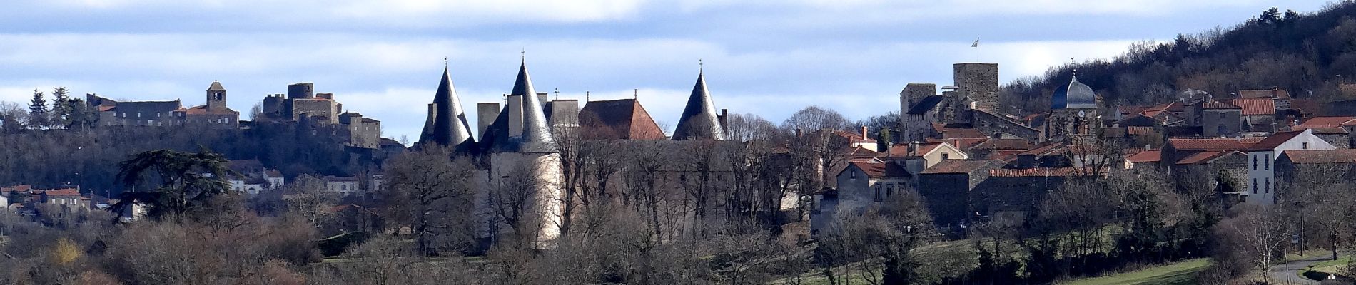
Mareugheol, Antoingt, Vodable, colamone sont autant de témoins figés dans la pierre de l'histoire du Lembron.
Photos

Positioning
Country:
France
Region :
Auvergne-Rhône-Alpes
Department/Province :
Puy-de-Dôme
Municipality :
Mareugheol
Location:
Unknown
Start:(Dec)
Start:(UTM)
512907 ; 5037247 (31T) N.
Comments